IMAGES TAKEN NEAR TO
Winslow, BROMYARD, HR7 4SB
Introduction
This page details the photographs taken nearby to HR7 4SB by members of the Geograph project.
The Geograph project started in 2005 with the aim of publishing, organising and preserving representative images for every square kilometre of Great Britain, Ireland and the Isle of Man.

There are currently over 7.5m images from over14,400 individuals and you can help contribute to the project by visiting https://www.geograph.org.uk
Image Map
Images are licensed for reuse under creativecommons.org/licenses/by-sa/2.0
Notes
- Clicking on the map will re-center to the selected point.
- The higher the marker number, the further away the image location is from the centre of the postcode.
Image Listing (9 Images Found)
Images are licensed for reuse under creativecommons.org/licenses/by-sa/2.0
Image
Details
Distance
1
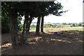
Bare earth, Hawkhurst
The unvegetated ground tells of shade loving sheep in a hot Summer.
Image: © Richard Webb
Taken: 6 Aug 2018
0.08 miles
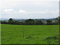
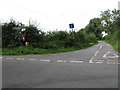
3
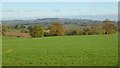
Pasture land at Munderfield crossroads
Looking west over the Pencombe Hills.
Image: © Jonathan Billinger
Taken: 16 Dec 2014
0.11 miles
5
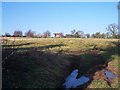
Upper Munderfield
Looking NW from Green Lane
Image: © Bob Embleton
Taken: 28 Jan 2006
0.18 miles
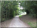
6
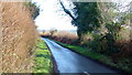
Green Lane
Looking east towards Bromyard.
Image: © Jonathan Billinger
Taken: 16 Dec 2014
0.18 miles
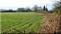
7
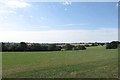
Grass, Upper Munderfield
Plateau surface on the high ground around Bromyard. A silage crop had been taken earlier in the Summer, but there has been little growth since due to lack of rain.
Image: © Richard Webb
Taken: 6 Aug 2018
0.22 miles
8
View to the Bromyard Downs
View to the Bromyard Downs from a country road to the south of Bredenbury.
Image: © Philip Halling
Taken: 11 Nov 2016
0.24 miles