
IMAGES TAKEN NEAR TO
Panniers Lane, Hereford Road, BROMYARD, HR7 4QU
Introduction
This page details the photographs taken nearby to Panniers Lane, Hereford Road, HR7 4QU by members of the Geograph project.
The Geograph project started in 2005 with the aim of publishing, organising and preserving representative images for every square kilometre of Great Britain, Ireland and the Isle of Man.

There are currently over 7.5m images from over14,400 individuals and you can help contribute to the project by visiting https://www.geograph.org.uk
Image Map
Images are licensed for reuse under creativecommons.org/licenses/by-sa/2.0
Notes
- Clicking on the map will re-center to the selected point.
- The higher the marker number, the further away the image location is from the centre of the postcode.
Image Listing (9 Images Found)
Images are licensed for reuse under creativecommons.org/licenses/by-sa/2.0
Image
Details
Distance
1
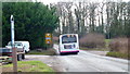
420 service to Hereford
The bus is on time (10:48) to arrive in Hereford at 11:20 this Christmas Eve.
View south along Pannier's Lane approaching the A465 Hereford Road.
Image: © Jonathan Billinger
Taken: 24 Dec 2014
0.06 miles
2
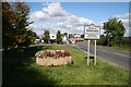
Welcome to Bromyard
The entrance to Bromyard on the A465 from Hereford.
Image: © Bob Embleton
Taken: 26 Sep 2007
0.07 miles
3
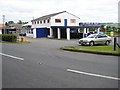
Top Garage, south of Bromyard
On the A465, with open views to the east.
Image: © Pauline E
Taken: 18 May 2008
0.08 miles
5
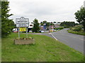
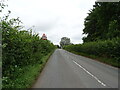
Welcome to Bromyard
Since an earlier Geograph picture was taken, a new sign has been erected: rather less flamboyant, but with posts a safer distance from the carriageway edge.
Image: © Peter Whatley
Taken: 22 Jul 2008
0.11 miles
6
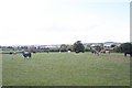
Cow Pasture
Between the roads to Pencombe and Bishop's Frome.
Image: © Bob Embleton
Taken: 26 Sep 2007
0.14 miles
7
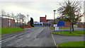
Queen Elizabeth Humanities College, Bromyard
Occupying a hilltop site off Panniers Lane to the west of the town centre.
Image: © Jonathan Billinger
Taken: 24 Dec 2014
0.17 miles
8
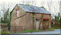
Old building, Pannier's Lane
Seen much better days and probably too close to the road junction to be of interest to developers.
Image: © Jonathan Billinger
Taken: 24 Dec 2014
0.18 miles
9

Old Milestone by the A465, Cooper's Green, Bromyard and Winslow parish
Stone post (plate lost and stone broken) by the A465, Hereford Road, in parish of BROMYARD AND WINSLOW (District), Cooper's Green, broken on verge, East side of road. Erected by the Bromyard turnpike trust in the 19th century.
Inscription once read:-
(Bromyard)
(1)
Herefordshire SMR.
SMR Number: 56572 https://www.heritagegateway.org.uk/Gateway/Results_Single.aspx?uid=MHE28329&resourceID=101
Milestone Society National ID: HF_HFBY13.
Image: © Robert Walker
Taken: 25 Feb 2012
0.21 miles