
IMAGES TAKEN NEAR TO
Delamere Road, BROMYARD, HR7 4QF
Introduction
This page details the photographs taken nearby to Delamere Road, HR7 4QF by members of the Geograph project.
The Geograph project started in 2005 with the aim of publishing, organising and preserving representative images for every square kilometre of Great Britain, Ireland and the Isle of Man.

There are currently over 7.5m images from over14,400 individuals and you can help contribute to the project by visiting https://www.geograph.org.uk
Image Map
Images are licensed for reuse under creativecommons.org/licenses/by-sa/2.0
Notes
- Clicking on the map will re-center to the selected point.
- The higher the marker number, the further away the image location is from the centre of the postcode.
Image Listing (7 Images Found)
Images are licensed for reuse under creativecommons.org/licenses/by-sa/2.0
Image
Details
Distance
1
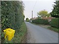
Tedstone Wafre
A row of mid 20th century brick houses of a kind familiar in Herefordshire.
Image: © Richard Webb
Taken: 21 Oct 2014
0.01 miles
2
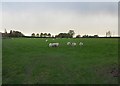
Sheep, Tedstone Wafre
Hilltop pasture.
Image: © Richard Webb
Taken: 21 Oct 2014
0.04 miles
3
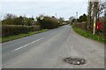
Tedstone Wafre
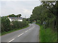
The B4203 at Tedstone Wafre. Viewing this scene today you would have no idea a telephone box once stood here, see Image
Image: © Philip Halling
Taken: 10 Apr 2022
0.07 miles
4
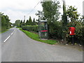
Still connected!
Tedstone Wafer retained a working public call box when this picture was taken. Goodness alone knows why! The B4203 heads north, untroubled by housing for some distance.
Image: © Peter Whatley
Taken: 25 Sep 2008
0.11 miles
6
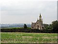
Remains of St James's Church, Tedstone Wafer
Image: © Peter Whatley
Taken: 25 Sep 2008
0.18 miles
7
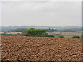
Rolling countryside opposite Tedstone Wafer phone box
Image: © Peter Whatley
Taken: 25 Sep 2008
0.21 miles