
IMAGES TAKEN NEAR TO
Twyning Street, BROMYARD, HR7 4BW
Introduction
This page details the photographs taken nearby to Twyning Street, HR7 4BW by members of the Geograph project.
The Geograph project started in 2005 with the aim of publishing, organising and preserving representative images for every square kilometre of Great Britain, Ireland and the Isle of Man.

There are currently over 7.5m images from over14,400 individuals and you can help contribute to the project by visiting https://www.geograph.org.uk
Image Map
Images are licensed for reuse under creativecommons.org/licenses/by-sa/2.0
Notes
- Clicking on the map will re-center to the selected point.
- The higher the marker number, the further away the image location is from the centre of the postcode.
Image Listing (481 Images Found)
Images are licensed for reuse under creativecommons.org/licenses/by-sa/2.0
Image
Details
Distance
1
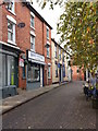
Bromyard - western side of Market Square
This narrow, one-way lane links Market Square and Rowberry Street and allows direct access to the frontages on the west side of the square.
Image: © Peter Whatley
Taken: 20 Oct 2012
0.01 miles
3
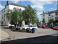
The Square, Bromyard
From Broad Street, with the Hop Pole Hotel behind the trees.
Image: © Pauline E
Taken: 18 May 2008
0.01 miles
4
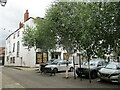
Market Square, Bromyard
Behind the trees stands the derelict Hop Pole Hotel which when I lived in Bromyard over 40 years ago was the premier licensed premise in the town, It dates from the eighteenth century https://historicengland.org.uk/listing/the-list/list-entry/1082324?section=official-list-entry
Image: © Jonathan Thacker
Taken: 23 Aug 2022
0.01 miles
5
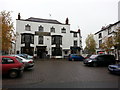
Bromyard - Market Square & The Hop Pole
Image: © Peter Whatley
Taken: 23 Oct 2012
0.01 miles
6
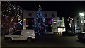
The Hop Pole (Bromyard)
The Hop Pole hotel at Bromyard was in a very jolly mood when I visited Bromyard, as most Christmas decorations, including a fantastic big Christmas tree, was surrounding the building area.
Image: © Fabian Musto
Taken: 4 Jan 2019
0.01 miles
7
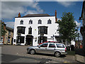
The Hop Pole Hotel, Bromyard
A former coaching inn situated in The Square, off Broad Street, Bromyard.
Image: © Pauline E
Taken: 18 May 2008
0.01 miles
8
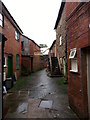
Bromyard - Tinton's Passage
The area between Broad/ High Streets and Rowberry Street is honeycombed with passages going back centuries. Two can be accessed by the public: the first is between the Queen's Arms and the Bengal Mix restaurant http://www.geograph.org.uk/photo/3186375. This is the second, a narrow passage giving access to Tinton's joinery business and various other industrial and domestic premises. The access from Broad Street is pictured here: http://www.geograph.org.uk/photo/3191261. The access from Rowberry Street you must find for yourself!
Image: © Peter Whatley
Taken: 23 Oct 2012
0.01 miles
10
Bromyard pubs - The Hop Pole Hotel
Partly obscured by the Christmas tree. Dates from the eighteenth century. http://www.britishlistedbuildings.co.uk/en-151036-hop-pole-hotel-bromyard-and-winslow-
Image: © Jonathan Thacker
Taken: 22 Nov 2013
0.01 miles