IMAGES TAKEN NEAR TO
Broxwood, LEOMINSTER, HR6 9JL
Introduction
This page details the photographs taken nearby to HR6 9JL by members of the Geograph project.
The Geograph project started in 2005 with the aim of publishing, organising and preserving representative images for every square kilometre of Great Britain, Ireland and the Isle of Man.

There are currently over 7.5m images from over14,400 individuals and you can help contribute to the project by visiting https://www.geograph.org.uk
Image Map (Loading...)


Getting Data...Please wait
Leaflet Map data © OpenStreetMap
Images are licensed for reuse under creativecommons.org/licenses/by-sa/2.0
Notes
- Clicking on the map will re-center to the selected point.
- The higher the marker number, the further away the image location is from the centre of the postcode.
Image Listing (5 Images Found)
Images are licensed for reuse under creativecommons.org/licenses/by-sa/2.0
Image
Details
Distance
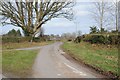
1
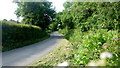
Broxwood Road
Looking south towards Meer Common.
Image: © Jonathan Billinger
Taken: 9 Jun 2016
0.02 miles
2
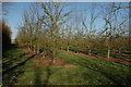
Pastoral scene, Broxwood
Almost park-like with mature oak and pastures.
Image: © Jonathan Billinger
Taken: 9 Jun 2016
0.09 miles
4
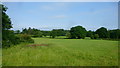
No through road to Lower and Upper Wetton
No through road to Lower and Upper Wetton near Broxwood.
Image: © Philip Halling
Taken: 23 Feb 2018
0.21 miles