
IMAGES TAKEN NEAR TO
Pear Tree Orchard, HR6 9GG
Introduction
This page details the photographs taken nearby to Pear Tree Orchard, HR6 9GG by members of the Geograph project.
The Geograph project started in 2005 with the aim of publishing, organising and preserving representative images for every square kilometre of Great Britain, Ireland and the Isle of Man.

There are currently over 7.5m images from over14,400 individuals and you can help contribute to the project by visiting https://www.geograph.org.uk
Image Map
Images are licensed for reuse under creativecommons.org/licenses/by-sa/2.0
Notes
- Clicking on the map will re-center to the selected point.
- The higher the marker number, the further away the image location is from the centre of the postcode.
Image Listing (16 Images Found)
Images are licensed for reuse under creativecommons.org/licenses/by-sa/2.0
Image
Details
Distance
1
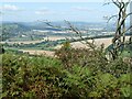
Looking towards Wigmore from Croft Ambrey
The views from here show why this was used as a hill fort.
Image: © Eric Marsh
Taken: 10 Sep 2009
0.05 miles
2

Old Milepost by the A4110, south of Wigmore
Wigmore iron casting by the A4110, in parish of Wigmore (Herefordshire District).
Lost since 2000.
Inscription reads:-
: HEREFORD / 20 : : KNIGHTON / 11 :
Herefordshire SMR.
SMR Number: 56831 https://www.heritagegateway.org.uk/Gateway/Results_Single.aspx?uid=MHE28586&resourceID=101
Milestone Society National ID: HF_HFKN20
Image: © Milestone Society
Taken: Unknown
0.08 miles
4
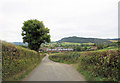
Un-named lane south of Lowerhouse Farm
Image: © Stuart Logan
Taken: 22 Sep 2013
0.14 miles
5
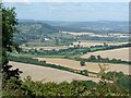
View towards Wigmore from Croft Ambrey
Looking northwest.
Image: © Eric Marsh
Taken: 10 Sep 2009
0.15 miles
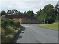
7
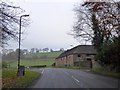
Brick barn by A4110, on southern edge of Wigmore
A substantial building (Victorian?) by the side of the road; beyond, on the right, are open fields, though on the left there is housing
Image: © David Smith
Taken: 29 Nov 2014
0.15 miles
8
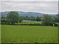
Vale of Wigmore
Once a glacial lake with an outlet into the Lugg southwards. A breach formed at Downton and drainage then switched to the course of the modern Teme. The consequences of this can be seen downstream with old river banks left high above the rejuvenated river and tributaries flowing in as if the direction of flow had changed.
Image: © Richard Webb
Taken: 14 Jun 2021
0.17 miles
9
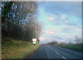
Wigmore town sign
Looking north-west along the A4110 as it approaches the short rise at Perrywood.
Image: © Trevor Rickard
Taken: 24 Nov 2008
0.18 miles
10
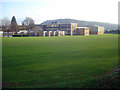
Wigmore schools - 1
Eastwards view across the playing field to Gatley Long Coppice on the hill behind. This well-manicured site consists of the primary school and high school
This view is of the high school.
http://www.wigmore.hereford.sch.uk/index.asp
Image: © Trevor Rickard
Taken: 24 Nov 2008
0.22 miles