
IMAGES TAKEN NEAR TO
Bearwood Lane, LEOMINSTER, HR6 9EA
Introduction
This page details the photographs taken nearby to Bearwood Lane, HR6 9EA by members of the Geograph project.
The Geograph project started in 2005 with the aim of publishing, organising and preserving representative images for every square kilometre of Great Britain, Ireland and the Isle of Man.

There are currently over 7.5m images from over14,400 individuals and you can help contribute to the project by visiting https://www.geograph.org.uk
Image Map
Images are licensed for reuse under creativecommons.org/licenses/by-sa/2.0
Notes
- Clicking on the map will re-center to the selected point.
- The higher the marker number, the further away the image location is from the centre of the postcode.
Image Listing (601 Images Found)
Images are licensed for reuse under creativecommons.org/licenses/by-sa/2.0
Image
Details
Distance
1
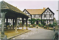
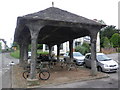
Pembridge, Market Hall and New Inn.
The New Inn dates from the 1600s and faces onto Pembridge's mediaeval village square.
Image: © Colin Smith
Taken: Unknown
0.01 miles
2
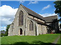
Grade I listed Church of St Mary, Pembridge
Nothing is known of the original Norman church which occupied this site.
The existing church was built between 1320 and 1360. Work was delayed because of the shortage of labour following the severe outbreak of bubonic plague in 1349, known as the Black Death.
The church was Grade I listed in October 1967. Grade I, the highest category, is awarded to buildings of exceptional interest, sometimes considered to be internationally important. Only 2.5% (25 in 1000) of all listed buildings are Grade I.
Image: © Jaggery
Taken: 22 Aug 2012
0.01 miles
3
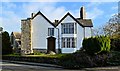
Court House Farmhouse, Pembridge
On an ancient site with a castle mound at the rear. Dating from the early 17th century, although I have my suspicions that it might be earlier. The West end of the church is seen to the left.
Image: © Philip Pankhurst
Taken: 8 Jan 2019
0.02 miles
4
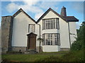
Court House Farmhouse (Pembridge)
This 17th century farmhouse was altered in the 18th century and was given more alterations in the 20th century.
Image: © Fabian Musto
Taken: 27 Jun 2020
0.02 miles
5
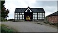
Timber Framed Threshing Barn at Court House
https://historicengland.org.uk/listing/the-list/list-entry/1301098?section=official-list-entry
Image: © Sandy Gerrard
Taken: 1 Oct 2022
0.02 miles
6
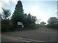
Entrance to Pembridge Primary School
The road leading to the primary school can be accessed through Bearwood Lane.
Image: © Fabian Musto
Taken: 27 Jun 2020
0.02 miles
8
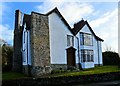
Court House farmhouse, Pembridge
On an ancient site with a castle mound at the rear. Dating from the early 17th century, although I have my suspicions that it might be earlier.
Image: © Philip Pankhurst
Taken: 8 Jan 2019
0.03 miles
9
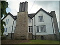
Court House Farmhouse (Pembridge)
This 17th century farmhouse was altered in the 18th century and was given more alterations in the 20th century.
Image: © Fabian Musto
Taken: 27 Jun 2020
0.03 miles
10
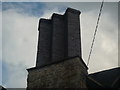
Chimney on Old Court Farmhouse (Pembridge)
A jazzy-design chimney on Old Court Farmhouse.
Image: © Fabian Musto
Taken: 27 Jun 2020
0.03 miles