
IMAGES TAKEN NEAR TO
High Street, LEOMINSTER, HR6 9DT
Introduction
This page details the photographs taken nearby to High Street, HR6 9DT by members of the Geograph project.
The Geograph project started in 2005 with the aim of publishing, organising and preserving representative images for every square kilometre of Great Britain, Ireland and the Isle of Man.

There are currently over 7.5m images from over14,400 individuals and you can help contribute to the project by visiting https://www.geograph.org.uk
Image Map
Images are licensed for reuse under creativecommons.org/licenses/by-sa/2.0
Notes
- Clicking on the map will re-center to the selected point.
- The higher the marker number, the further away the image location is from the centre of the postcode.
Image Listing (641 Images Found)
Images are licensed for reuse under creativecommons.org/licenses/by-sa/2.0
Image
Details
Distance
1
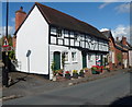
Cherry Tree Cottage, Pembridge
Large detached black and white cottage on High Street, next door to the Methodist chapel http://www.geograph.org.uk/photo/3096464 and facing the New Inn. http://www.geograph.org.uk/photo/3096352 The three front doors suggested three cottages, but Cherry Tree Cottage is shown on the door on the left and on the wall at the chapel end. Only the leftmost door has a letterbox.
Image: © Jaggery
Taken: 22 Aug 2012
0.01 miles
2
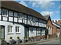
Highways, West Street, Pembridge
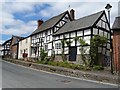
Timber framed house, formerly a range of cottages, dating back to possibly the 16th century, but with later modifications. Listed Grade II.
Image: © Alan Murray-Rust
Taken: 26 Apr 2016
0.01 miles
3
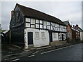
Highways, Pembridge
Probably dates from the sixteenth century https://historicengland.org.uk/listing/the-list/list-entry/1081735?section=official-list-entry
Image: © Jonathan Thacker
Taken: 22 Aug 2022
0.01 miles
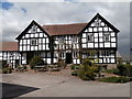
6
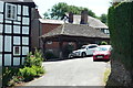
Pembridge Market Hall
One of the most special gems in the village of Pembridge is this building, which is the former market hall, which was built in the 16th century by having two storeys originally, the upper one being removed for unknown reasons. Friends with the New Inn since that building was built.
Image: © Fabian Musto
Taken: 7 Jul 2018
0.01 miles
7
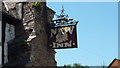
Sign at The New Inn (Pembridge)
Looks like this sign was made in an old-fashioned style, unless if this sign is actually old-fashioned, then apologies for that.
Image: © Fabian Musto
Taken: 7 Jul 2018
0.01 miles
8
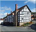
Grade II listed The New Inn, Pembridge
Viewed across the A44. The New Inn is located between the two arms of the northern end of Bearwood Lane. It is near the Market Hall, http://www.geograph.org.uk/photo/3096093 part of which is at the right edge of the view.
The New Inn dates from the 17th century, with later alterations. Grade II listed in August 1953.
Image: © Jaggery
Taken: 22 Aug 2012
0.01 miles
9
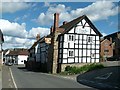
The New Inn, Pembridge
Built in the 17th century as a house, later becoming a roadside inn. It has later modifications. This end appears to have been a barn or stables built for the house at the same period, although it has since been converted to domestic use. Listed Grade II.
What appears to be a very ordinary minor village street is fact the A44 trunk road between London and Aberystwyth.
Image: © Alan Murray-Rust
Taken: 26 Apr 2016
0.01 miles
10
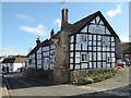
New Inn, Pembridge
The New Inn in Pembridge dates from the 17th century and is a Grade II listed building.
Image]
Image: © Philip Halling
Taken: 2 Feb 2018
0.01 miles