
IMAGES TAKEN NEAR TO
Hatfield, LEOMINSTER, HR6 0SQ
Introduction
This page details the photographs taken nearby to HR6 0SQ by members of the Geograph project.
The Geograph project started in 2005 with the aim of publishing, organising and preserving representative images for every square kilometre of Great Britain, Ireland and the Isle of Man.

There are currently over 7.5m images from over14,400 individuals and you can help contribute to the project by visiting https://www.geograph.org.uk
Image Map
Images are licensed for reuse under creativecommons.org/licenses/by-sa/2.0
Notes
- Clicking on the map will re-center to the selected point.
- The higher the marker number, the further away the image location is from the centre of the postcode.
Image Listing (21 Images Found)
Images are licensed for reuse under creativecommons.org/licenses/by-sa/2.0
Image
Details
Distance
1
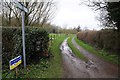
Footpath to Hatfield
This footpath to Hatfield is also the route of the Herefordshire Trail.
Image: © Philip Halling
Taken: 28 Dec 2015
0.06 miles
2
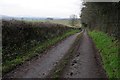
No through road
No through road providing access to farm buildings and farmland near Hatfield.
Image: © Philip Halling
Taken: 28 Dec 2015
0.10 miles
3
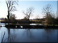
Divided Pond
A rather curious feature. The pond close to Westwood Farm is divided by a stone wall. Looking west.
Image: © Bob Embleton
Taken: 28 Jan 2006
0.17 miles
4
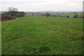
Farmland near Thornbury
Farmland to the south-west of Thornbury, the Malvern Hills can be seen in the distance.
Image: © Philip Halling
Taken: 28 Dec 2015
0.18 miles
5
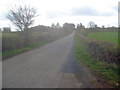
Lane to Fencote Station
Looking south to the small rise in the lane which marks the bridge over the railway. The station, now a private house, is in the clump of trees on the left.
Image: © Trevor Rickard
Taken: 8 Apr 2009
0.19 miles
6

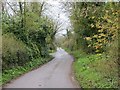
The Herefordshire Trail (Hatfield)
The Herefordshire Trail is a long-distance footpath that tours Herefordshire for 154-miles. This section of the trail is on the parish boundary between Hatfield and Thornbury.
Image: © Fabian Musto
Taken: 26 Jun 2025
0.19 miles
8
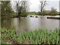
Pond, Westwood
With a wall running through it.
Image: © Richard Webb
Taken: 6 Apr 2014
0.20 miles
9
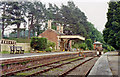
Fencote station (preserved), 1992
View SE, towards Bromyard and Worcester: ex-GWR (Worcester) - Bransford Road - Bromyard - Leominster line, closed Bromyard - Leominster 15/9/52, remainder 7/9/64. Fencote station was purchased privately in 1980 and restored with some track, then in 1984 the next station west, Rowden Mill, was also purchased and the track between the two stations was restored, for a while. This is apparently not normally open to the public and seems to have fallen into disuse anyway.
Image: © Ben Brooksbank
Taken: 27 Jun 1992
0.23 miles
10
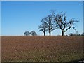
Trees on Skyline, near Westwood Farm
Looking east from the road from Hampton Charles to Grendon Green.
Image: © Bob Embleton
Taken: 28 Jan 2006
0.23 miles