
IMAGES TAKEN NEAR TO
Markwick Close, KINGTON, HR5 3UE
Introduction
This page details the photographs taken nearby to Markwick Close, HR5 3UE by members of the Geograph project.
The Geograph project started in 2005 with the aim of publishing, organising and preserving representative images for every square kilometre of Great Britain, Ireland and the Isle of Man.

There are currently over 7.5m images from over14,400 individuals and you can help contribute to the project by visiting https://www.geograph.org.uk
Image Map
Images are licensed for reuse under creativecommons.org/licenses/by-sa/2.0
Notes
- Clicking on the map will re-center to the selected point.
- The higher the marker number, the further away the image location is from the centre of the postcode.
Image Listing (275 Images Found)
Images are licensed for reuse under creativecommons.org/licenses/by-sa/2.0
Image
Details
Distance
1
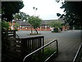
Co-op (Kington)
The main supermarket that provides the town of Kington and surrounding settlements is Co-op, which has suffered terrible fates in the past few years.
Image: © Fabian Musto
Taken: 30 Jun 2020
0.03 miles
2
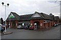
Co-op supermarket
In Crabtree Road south of the High Street.
Will the introduction of a supermarket be the death knell to the small family businesses which make Kington such a lovely shopping experience?
Image: © Bob Embleton
Taken: 27 Feb 2010
0.04 miles
3
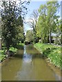
Mill Leat at Arrow Mill
Taking water from a weir on the River Arrow.
Image: © John M
Taken: 12 May 2012
0.05 miles
4
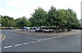
Crabtree Road car park, Kington
Viewed from the corner of Mill Street. This is a pay and display car park. The ticket I bought, for a 2 hour stay, cost 70 pence (late June 2013 prices). I didn't record the cost for other periods, but I recall that 3 hours was £1.10. The minimum charge was 40 pence for up to an hour.
Image: © Jaggery
Taken: 26 Jun 2013
0.05 miles
5
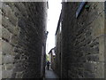
Mill Furlong Lane, south of the High Street, Kington
Image: © Alex McGregor
Taken: 2 Nov 2010
0.05 miles
6
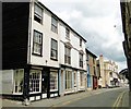
Duke Street, Kington
Looking towards the Oxford Arms and beyond. This long road led to the railway station, which closed in 1955. It now leads to the bypass.
Image: © Philip Pankhurst
Taken: 6 Jun 2010
0.05 miles
7
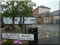
NFU Mutual (Kington)
Here is NFU Mutual in Kington, which is placed by Crabtree Road and a large car park.
Image: © Fabian Musto
Taken: 30 Jun 2020
0.06 miles
8
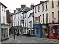
Kington High Street - Upper Cross end
A fascinating trading centre with many long-established businesses, all being run from ancient premises. Some are quite humble like The Chocolate Box, while others are stately, like the neighbour of the Wine Vaults with its Gothick variant of the Venetian window high up in the gable.
Image: © Philip Pankhurst
Taken: 6 Jun 2010
0.06 miles
9
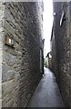
Furlong Lane
Viewed from the High Street showing the sandstone rubble walls.
The narrow lanes are a component of the medieval planned borough of New Kington.
In a report for the Conservation Area it is described:
" .. the narrow lane is enclosed by the dark stone walls of tall buildings creating the metaphor of a deep canyon."
Image: © Bob Embleton
Taken: 27 Feb 2010
0.06 miles
10
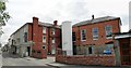
Burton Hotel, Kington
Large coaching inn at the heart of the town. The large windowed extension was the Assembly Room of 1856 - now a health and fitness club, Cloud Nine. When I first saw what they had done to the building, I was not on cloud nine, but it brings revenue to keep the hotel going, and it offers a service to the town.
Image: © Philip Pankhurst
Taken: 6 Jun 2010
0.06 miles