
IMAGES TAKEN NEAR TO
Meads Close, KINGTON, HR5 3TB
Introduction
This page details the photographs taken nearby to Meads Close, HR5 3TB by members of the Geograph project.
The Geograph project started in 2005 with the aim of publishing, organising and preserving representative images for every square kilometre of Great Britain, Ireland and the Isle of Man.

There are currently over 7.5m images from over14,400 individuals and you can help contribute to the project by visiting https://www.geograph.org.uk
Image Map
Images are licensed for reuse under creativecommons.org/licenses/by-sa/2.0
Notes
- Clicking on the map will re-center to the selected point.
- The higher the marker number, the further away the image location is from the centre of the postcode.
Image Listing (115 Images Found)
Images are licensed for reuse under creativecommons.org/licenses/by-sa/2.0
Image
Details
Distance

2
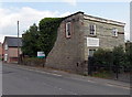
Victoria Road development site, Kington
A sign at the edge of Victoria Road shows DEVELOPMENT SITE FOR TEN UNITS (units here = houses). The site is an adjacent area of land in Ernest Deacon Ltd's yard.
Image: © Jaggery
Taken: 26 Jun 2013
0.04 miles
3
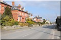
Victoria Road, Kington
Residential road leading into the centre of Kington.
Image: © Philip Halling
Taken: 23 Feb 2018
0.05 miles
4
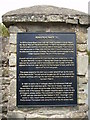
Cast iron information sign
Sited on the old tramway out of Kington this sign explains the history of the old Tramway that ran via Hay on Wye to the Brecon Canal. It is located near to the old Kington railway station. The railway came in 1857 however, passenger traffic ceased in 1955, with freight traffic continuing until 1964, when the line closed.
Image: © Phil Catterall
Taken: 11 Aug 2006
0.05 miles
5

Victoria Mews, Kington
Victoria Mews is a row of 5 houses viewed across Victoria Road looking towards Elizabeth Road.
Image: © Jaggery
Taken: 26 Jun 2013
0.05 miles
6
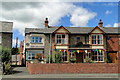
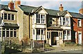
Ye Olde Tavern, Victoria Road, Sunset, Kington
Looking now like a Victorian terraced house, there has been a pub here for more than 200 years. Originally called the House in the Fields, it became the Railway Tavern when the trains came, changing again to its present identity when the line finally closed in 1964. Until recently beer was brewed here, but it is still highly rated, winning the local CAMRA title in 2009.
Image: © Philip Pankhurst
Taken: 5 Jul 2010
0.05 miles
7
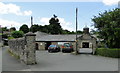
Meredith's Foundry, Sunset, Kington
Established in 1820 by John Meredith. The Kington Tramway ran around the site, hugging the wall on the left.
Image: © Philip Pankhurst
Taken: 5 Jul 2010
0.06 miles
9
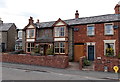
Ye Olde Tavern, Kington
Victoria Road pub opposite Elizabeth Road, at the eastern edge of town. The name on the board (centre left) is inconspicuous. More noticeable is ESTD (established) 1767 between the board and the door.
See http://www.geograph.org.uk/photo/1948970 for an earlier view and some details.
Image: © Jaggery
Taken: 26 Jun 2013
0.06 miles
10

Eastern boundary of Kington
The boundary sign is at the eastern end of Victoria Road, near the roundabout at the A44 junction. Kington is a small town in NW Herefordshire.
Image: © Jaggery
Taken: 26 Jun 2013
0.06 miles