
IMAGES TAKEN NEAR TO
Hatton Place, KINGTON, HR5 3NJ
Introduction
This page details the photographs taken nearby to Hatton Place, HR5 3NJ by members of the Geograph project.
The Geograph project started in 2005 with the aim of publishing, organising and preserving representative images for every square kilometre of Great Britain, Ireland and the Isle of Man.

There are currently over 7.5m images from over14,400 individuals and you can help contribute to the project by visiting https://www.geograph.org.uk
Image Map
Images are licensed for reuse under creativecommons.org/licenses/by-sa/2.0
Notes
- Clicking on the map will re-center to the selected point.
- The higher the marker number, the further away the image location is from the centre of the postcode.
Image Listing (14 Images Found)
Images are licensed for reuse under creativecommons.org/licenses/by-sa/2.0
Image
Details
Distance
2
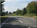
A44 at the junction for Newton
The road joining on the left is the old route via Kington town centre.
Image: © Peter Whatley
Taken: 1 Sep 2011
0.04 miles
3
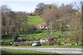
Hillside above Floodgates
In the foreground is the A44 to the west of Kington.
Image: © Jonathan Billinger
Taken: 6 Apr 2007
0.06 miles
4
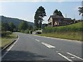
A44 on the western outskirts of Kington
Image: © Peter Whatley
Taken: 1 Sep 2011
0.16 miles
5
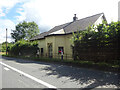
Toll House, Kington
"The Toll House" on the A44 NW of Kington in the area known as Floodgates. Erected by the Kington Turnpike Trust in the 19ᵗʰ C. More local toll houses see https://www.geograph.org.uk/discuss/index.php?&action=vthread&forum=11&topic=33104
Milestone Society National ID: HF.KIN01
Image: © Mr Red
Taken: 9 Sep 2022
0.19 miles
6
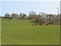
Mixen and farmland, Floodgates
The lower, cultivated slopes of Bradnor Hill. The muck is about to be spread to feed the spring growth of the grass.
Image: © Richard Webb
Taken: 1 Apr 2007
0.19 miles
7
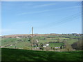
Field off Ridgebourne Road in April
Spring is advancing. Two buzzards circle thermals in the valley and the grass is lush and green.
Image: © Jeremy Bolwell
Taken: 9 Apr 2011
0.21 miles
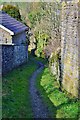
9
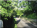
Ridgebourne Road, Kington
Leads off Hergest Ridge, passing the Gardens of Hergest Croft before heading off towards the town centre.
Image: © Chris Heaton
Taken: 15 May 2007
0.22 miles
10
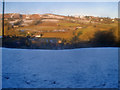
Snow covered field north of Ridgebourne Road
Looking north from the lane across Back Brook valley to Bradnor Hill, home of Kington Golf Club, the highest golf club in England. Parts of the course can be seen on the top of the hill. The winter sun has melted most of the snow on south-facing slopes opposite, but this side is in the shade all day.
Image: © Trevor Rickard
Taken: 4 Jan 2010
0.22 miles