
IMAGES TAKEN NEAR TO
Floodgates, KINGTON, HR5 3NF
Introduction
This page details the photographs taken nearby to HR5 3NF by members of the Geograph project.
The Geograph project started in 2005 with the aim of publishing, organising and preserving representative images for every square kilometre of Great Britain, Ireland and the Isle of Man.

There are currently over 7.5m images from over14,400 individuals and you can help contribute to the project by visiting https://www.geograph.org.uk
Image Map
Images are licensed for reuse under creativecommons.org/licenses/by-sa/2.0
Notes
- Clicking on the map will re-center to the selected point.
- The higher the marker number, the further away the image location is from the centre of the postcode.
Image Listing (41 Images Found)
Images are licensed for reuse under creativecommons.org/licenses/by-sa/2.0
Image
Details
Distance
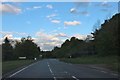
2
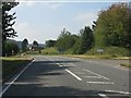
A44 at the junction for Newton
The road joining on the left is the old route via Kington town centre.
Image: © Peter Whatley
Taken: 1 Sep 2011
0.12 miles
3
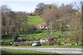
Hillside above Floodgates
In the foreground is the A44 to the west of Kington.
Image: © Jonathan Billinger
Taken: 6 Apr 2007
0.13 miles
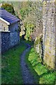
5
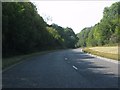
A44 Kington bypass curving near Newton
Graceful curves take the bypass round a spur of high ground.
Image: © Peter Whatley
Taken: 1 Sep 2011
0.15 miles
6
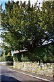
A Yew Tree and A Yew Hedge
Next to the Church in Kington is this well kept Hedge and Tree
Image: © paul wood
Taken: 18 Mar 2015
0.18 miles
7
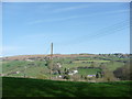
Field off Ridgebourne Road in April
Spring is advancing. Two buzzards circle thermals in the valley and the grass is lush and green.
Image: © Jeremy Bolwell
Taken: 9 Apr 2011
0.19 miles
8
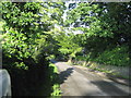
Ridgebourne Road, Kington
Leads off Hergest Ridge, passing the Gardens of Hergest Croft before heading off towards the town centre.
Image: © Chris Heaton
Taken: 15 May 2007
0.19 miles
9
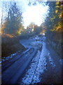
End of Ridgebourne Road
View east to the junction with Montfort Road. Always in the shade in the winter, both the road and the raised pavement were very slippery after several days of frost and snow.
Image: © Trevor Rickard
Taken: 4 Jan 2010
0.19 miles
10
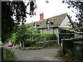
Wych House, Kington
Dates from the early nineteenth century https://historicengland.org.uk/listing/the-list/list-entry/1208078?section=official-list-entry
Image: © Jonathan Thacker
Taken: 22 Aug 2022
0.19 miles