IMAGES TAKEN NEAR TO
Lyonshall, KINGTON, HR5 3HY
Introduction
This page details the photographs taken nearby to HR5 3HY by members of the Geograph project.
The Geograph project started in 2005 with the aim of publishing, organising and preserving representative images for every square kilometre of Great Britain, Ireland and the Isle of Man.

There are currently over 7.5m images from over14,400 individuals and you can help contribute to the project by visiting https://www.geograph.org.uk
Image Map (Loading...)


Getting Data...Please wait
Leaflet Map data © OpenStreetMap
Images are licensed for reuse under creativecommons.org/licenses/by-sa/2.0
Notes
- Clicking on the map will re-center to the selected point.
- The higher the marker number, the further away the image location is from the centre of the postcode.
Image Listing (6 Images Found)
Images are licensed for reuse under creativecommons.org/licenses/by-sa/2.0
Image
Details
Distance
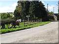
3
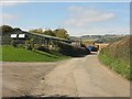
Farm buildings at the western extremity of Nextend
Image: © Peter Whatley
Taken: 27 Sep 2011
0.14 miles
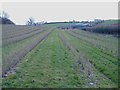
4
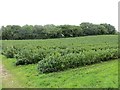
Blackcurrants, Parkgate
Fruit growing between the road and railway trackbed.
Image: © Richard Webb
Taken: 9 Aug 2013
0.21 miles
5
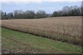
Currant bushes
Currant bushes in a field near Parkgate, Titley.
Image: © Philip Halling
Taken: 23 Feb 2018
0.23 miles