
IMAGES TAKEN NEAR TO
Lower Cross, KINGTON, HR5 3BG
Introduction
This page details the photographs taken nearby to Lower Cross, HR5 3BG by members of the Geograph project.
The Geograph project started in 2005 with the aim of publishing, organising and preserving representative images for every square kilometre of Great Britain, Ireland and the Isle of Man.

There are currently over 7.5m images from over14,400 individuals and you can help contribute to the project by visiting https://www.geograph.org.uk
Image Map
Images are licensed for reuse under creativecommons.org/licenses/by-sa/2.0
Notes
- Clicking on the map will re-center to the selected point.
- The higher the marker number, the further away the image location is from the centre of the postcode.
Image Listing (299 Images Found)
Images are licensed for reuse under creativecommons.org/licenses/by-sa/2.0
Image
Details
Distance
1
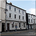
HSBC Kington
Bank branch at 1 High Street, opposite Bridge Street. A plaque http://www.geograph.org.uk/photo/3534857 on the wall records that the branch was formerly the Kington & Radnorshire Bank, established in 1808.
Image: © Jaggery
Taken: 26 Jun 2013
0.01 miles
2
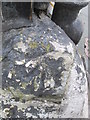
Ordnance Survey Rivet
This OS rivet can be found on the stone at the junction of Duke Street. It marks a point 156.987m above mean sea level.
Image: © Adrian Dust
Taken: 19 Nov 2015
0.01 miles
3
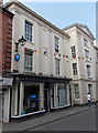
Barclays Bank, Kington
Bank branch at 4 High Street, near the Bridge Street junction.
Image: © Jaggery
Taken: 26 Jun 2013
0.01 miles
4
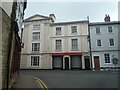
Kington Town Hall
This was built as the town hall in 1845 by Benjamin Wishlade, who lived at Duke Street in Kington; that is also the same street where he built this! The building was no longer a town hall by the 1970s, and this has housed shops since.
Image: © Fabian Musto
Taken: 30 Jun 2020
0.01 miles
5
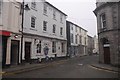
HSBC bank, Kington
If I recall correctly, this was about to close.
Image: © Richard Webb
Taken: 28 Dec 2016
0.01 miles
6
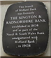
Kington & Radnorshire Bank plaque, Kington
The plaque is on the wall here. http://www.geograph.org.uk/photo/3534850
Since the plaque was installed, the Midland Bank has become HSBC.
Image: © Jaggery
Taken: 26 Jun 2013
0.02 miles
7
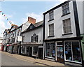
Paul Lewis butcher shop, Kington
The butcher's shop in the middle of the view is at 49 High Street.
On the right is Kington & District community shop.
Image: © Jaggery
Taken: 26 Jun 2013
0.02 miles
8
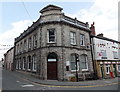
The Kington Centre, Kington
The building on the corner of Bridge Street and Duke Street dates from 1905. http://www.geograph.org.uk/photo/1902033
Now housing The Kington Centre owned by Herefordshire Council, this is the town's library and also an access centre for a wide range of information and advice on a number of council services.
Image: © Jaggery
Taken: 26 Jun 2013
0.02 miles
9
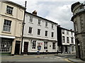
HSBC, Kington branch
Elegant neighbour to the former town hall, now the local HSBC branch. Ionic pilasters are not an everyday sight in this part of the Borderlands.
October 2017 : This bank branch has now closed, as have all of the other banks in the town, an area where the internet is still a thing of mystery to many.
Image: © Philip Pankhurst
Taken: 6 Jun 2010
0.02 miles
10
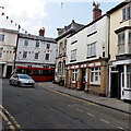
Kington post office
The post office is at 63 Bridge Street, a few metres from the corner of High Street and Duke Street.
Image: © Jaggery
Taken: 26 Jun 2013
0.02 miles