
IMAGES TAKEN NEAR TO
Castle Hill, Broken Bank, KINGTON, HR5 3AH
Introduction
This page details the photographs taken nearby to Castle Hill, Broken Bank, HR5 3AH by members of the Geograph project.
The Geograph project started in 2005 with the aim of publishing, organising and preserving representative images for every square kilometre of Great Britain, Ireland and the Isle of Man.

There are currently over 7.5m images from over14,400 individuals and you can help contribute to the project by visiting https://www.geograph.org.uk
Image Map
Images are licensed for reuse under creativecommons.org/licenses/by-sa/2.0
Notes
- Clicking on the map will re-center to the selected point.
- The higher the marker number, the further away the image location is from the centre of the postcode.
Image Listing (68 Images Found)
Images are licensed for reuse under creativecommons.org/licenses/by-sa/2.0
Image
Details
Distance
1
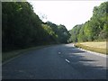
A44 Kington bypass curving near Newton
Graceful curves take the bypass round a spur of high ground.
Image: © Peter Whatley
Taken: 1 Sep 2011
0.04 miles
3
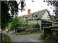
Wych House, Kington
Dates from the early nineteenth century https://historicengland.org.uk/listing/the-list/list-entry/1208078?section=official-list-entry
Image: © Jonathan Thacker
Taken: 22 Aug 2022
0.09 miles
4
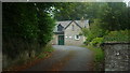
St. Mary's Church Hall (Kington)
The stone church hall stands very close to the church of St. Mary.
Image: © Fabian Musto
Taken: 15 Aug 2019
0.09 miles
5
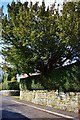
A Yew Tree and A Yew Hedge
Next to the Church in Kington is this well kept Hedge and Tree
Image: © paul wood
Taken: 18 Mar 2015
0.10 miles
6
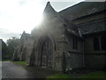
St. Mary's Church (Porch #2 | Kington)
On the north side of this church was another porch, but this one was locked.
Image: © Fabian Musto
Taken: 15 Aug 2019
0.10 miles
7
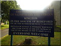
Sign at St. Mary's Church (Kington)
This entrance sign is placed at the west entrance to this town church.
Image: © Fabian Musto
Taken: 15 Aug 2019
0.10 miles
8
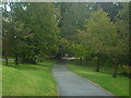
Path to St. Mary's Church (Kington)
This view is looking down towards the lychgate.
Image: © Fabian Musto
Taken: 15 Aug 2019
0.10 miles
9
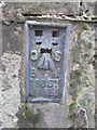
Ordnance Survey Flush Bracket (11657)
This OS Flush Bracket can be found on the north face of St Mary's Church. It marks a point 195.913m above mean sea level.
Image: © Adrian Dust
Taken: 19 Nov 2015
0.10 miles
10
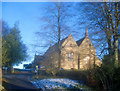
Entrance to St Mary's Church
Short entrance road leading up to the churchyard, which has a commanding position above the town.
Image: © Trevor Rickard
Taken: 4 Jan 2010
0.10 miles