
IMAGES TAKEN NEAR TO
The Marsh, HEREFORD, HR4 8DU
Introduction
This page details the photographs taken nearby to The Marsh, HR4 8DU by members of the Geograph project.
The Geograph project started in 2005 with the aim of publishing, organising and preserving representative images for every square kilometre of Great Britain, Ireland and the Isle of Man.

There are currently over 7.5m images from over14,400 individuals and you can help contribute to the project by visiting https://www.geograph.org.uk
Image Map
Images are licensed for reuse under creativecommons.org/licenses/by-sa/2.0
Notes
- Clicking on the map will re-center to the selected point.
- The higher the marker number, the further away the image location is from the centre of the postcode.
Image Listing (10 Images Found)
Images are licensed for reuse under creativecommons.org/licenses/by-sa/2.0
Image
Details
Distance
2
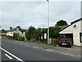
2024 UK General Election: my one and only Reform poster
I initially didn't put this on because David Smith https://www.geograph.org.uk/photo/7052576 had snapped it in 2021, but it is the only Reform poster I saw
Image: © Basher Eyre
Taken: 23 Jun 2024
0.05 miles
5

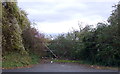
A49 near Marsh House Farm
Towards Leominster.
Image: © JThomas
Taken: 2 Nov 2019
0.10 miles
9
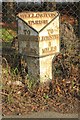
Old Milepost by the A49, Wellington Marsh
Cast iron post by the A49, in parish of WELLINGTON (District), Wellington Marsh, 250m South of Almshouses, up against a high chainlink fence, on East side of road. Hodges iron T-post, erected by the Hereford turnpike trust in the 19th century.
Inscription reads:-
: TO / HEREFORD / 5 / MILES : : WELLINGTON / PARISH : : TO / LEOM'STER / 8 / MILES :
Grade II listed.
List Entry Number: 1179608 https://historicengland.org.uk/listing/the-list/list-entry/1179608
Milestone Society National ID: HF_HFLM05.
Image: © R Lett & A Rosevear
Taken: 11 Apr 2010
0.21 miles
10
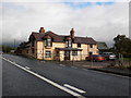
Roadside house, on the A49, between Hereford and Leominster
Image: © Roger Cornfoot
Taken: 24 Oct 2009
0.21 miles