IMAGES TAKEN NEAR TO
Westhope, HEREFORD, HR4 8BU
Introduction
This page details the photographs taken nearby to HR4 8BU by members of the Geograph project.
The Geograph project started in 2005 with the aim of publishing, organising and preserving representative images for every square kilometre of Great Britain, Ireland and the Isle of Man.

There are currently over 7.5m images from over14,400 individuals and you can help contribute to the project by visiting https://www.geograph.org.uk
Image Map
Images are licensed for reuse under creativecommons.org/licenses/by-sa/2.0
Notes
- Clicking on the map will re-center to the selected point.
- The higher the marker number, the further away the image location is from the centre of the postcode.
Image Listing (10 Images Found)
Images are licensed for reuse under creativecommons.org/licenses/by-sa/2.0
Image
Details
Distance
2
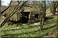
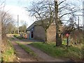
Old shed in an orchard at Westhope
This old shed in an orchard beside a steep lane up to Westhope Common looks like it could be in Italy.
Image: © Philip Halling
Taken: 11 Feb 2007
0.18 miles
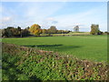
3
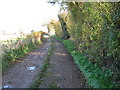
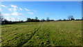
Westhope Common
Large area of common land which covers most of Westhope Hill and provides grazing for animals and a great picnic site. From this entrance there is not much to see, but cresting the hilltop provides extensive views in all directions - well worth the climb!
Image: © Trevor Rickard
Taken: 20 Oct 2010
0.20 miles
6
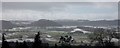
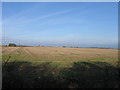
View to the west from Westhope
View over a snowy Herefordshire from Westhope. The wooded hill in the middle distance to the left of centre is Butthouse Knapp.
Image: © Philip Halling
Taken: 11 Feb 2007
0.23 miles
7
Westhope Common, 3
There are a few houses along the western edge of the common land.
Image: © Jonathan Billinger
Taken: 14 Jan 2016
0.23 miles
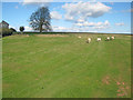
8
Barn conversion, Westhope Common
Very desirable property on the edge of the common.
Image: © Philip Pankhurst
Taken: 30 Jan 2008
0.24 miles
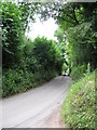
10
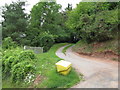
Switchback access road, Westhope
A remarkably steep and twisty access to houses in the upper part of Westhope, involving two hairpin bends and a steep,unbroken descent.
Image: © Peter Whatley
Taken: 26 Jul 2010
0.25 miles