
IMAGES TAKEN NEAR TO
Burghill, HEREFORD, HR4 7RS
Introduction
This page details the photographs taken nearby to HR4 7RS by members of the Geograph project.
The Geograph project started in 2005 with the aim of publishing, organising and preserving representative images for every square kilometre of Great Britain, Ireland and the Isle of Man.

There are currently over 7.5m images from over14,400 individuals and you can help contribute to the project by visiting https://www.geograph.org.uk
Image Map
Images are licensed for reuse under creativecommons.org/licenses/by-sa/2.0
Notes
- Clicking on the map will re-center to the selected point.
- The higher the marker number, the further away the image location is from the centre of the postcode.
Image Listing (12 Images Found)
Images are licensed for reuse under creativecommons.org/licenses/by-sa/2.0
Image
Details
Distance
1
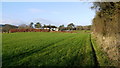
Public path on a field edge
The path goes around the house to emerge at Image
Image: © Jonathan Billinger
Taken: 20 Dec 2013
0.04 miles
2
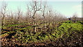
Apple orchard at Tillington
These are dessert apples as opposed to cider.
The differences are the small size to facilitate hand-picking and the high density of planting to get the best return for unit of land.
Image: © Jonathan Billinger
Taken: 20 Dec 2013
0.08 miles
3
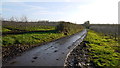
Orchard Road, Tillington
These are dessert apples as opposed to cider.
The differences are the small size to facilitate hand-picking and the high density of planting to get the best return for unit of land.
Image: © Jonathan Billinger
Taken: 20 Dec 2013
0.09 miles
4
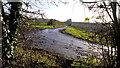
Orchard road
Dessert apple orchards near Tillington, viewed as emerging from the kissing gate on the footpath entering the square from the west.
Image: © Jonathan Billinger
Taken: 20 Dec 2013
0.09 miles
5
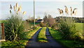
Private drive with pampas grasses
The public path heads off left to avoid the property.
Image: © Jonathan Billinger
Taken: 20 Dec 2013
0.10 miles
6
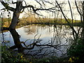
Large pond at Tillington
Hidden away near the village shop.
Image: © Jonathan Billinger
Taken: 20 Dec 2013
0.11 miles
7

Lane at Tillington
The Three Rivers Ride bridleway is on this country lane as well.
Image: © Fabian Musto
Taken: 23 Apr 2026
0.14 miles
8

Farmland at Tillington
Viewed from the Three Rivers Ride on a country lane to the west. Burghill Community Academy in the distance was built in 1851, and the school building was altered with Gothic features from 1872-74 (source: 'Herefordshire: Pevsner Architectural Guides' by Alan Brooks and Nikolaus Pevsner).
Image: © Fabian Musto
Taken: 23 Apr 2026
0.14 miles
9
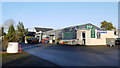
Tillington village store
The business also serves the adjoining caravan site and does garage services too.
Image: © Jonathan Billinger
Taken: 20 Dec 2013
0.16 miles
10
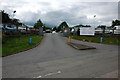
Village shop at Tillington
More than the average village shop, this one also sells cars.
Image: © Philip Halling
Taken: 16 Jun 2007
0.17 miles