IMAGES TAKEN NEAR TO
Staunton-on-Wye, HEREFORD, HR4 7NG
Introduction
This page details the photographs taken nearby to HR4 7NG by members of the Geograph project.
The Geograph project started in 2005 with the aim of publishing, organising and preserving representative images for every square kilometre of Great Britain, Ireland and the Isle of Man.

There are currently over 7.5m images from over14,400 individuals and you can help contribute to the project by visiting https://www.geograph.org.uk
Image Map
Images are licensed for reuse under creativecommons.org/licenses/by-sa/2.0
Notes
- Clicking on the map will re-center to the selected point.
- The higher the marker number, the further away the image location is from the centre of the postcode.
Image Listing (12 Images Found)
Images are licensed for reuse under creativecommons.org/licenses/by-sa/2.0
Image
Details
Distance
1
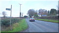
A438 near Staunton-on-Wye
Looking west towards Brecon.
Image: © Jonathan Billinger
Taken: 13 Jan 2016
0.02 miles
2
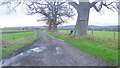
Track and bridleway
Leading to Dairy House Farm from the A438.
Image: © Jonathan Billinger
Taken: 13 Jan 2016
0.06 miles
3
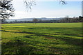
Arable land at Staunton on Wye
Large field of winter cereals to the south of the A438 at Staunton on Wye.
Image: © Philip Halling
Taken: 28 Jan 2012
0.07 miles
4
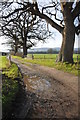
Bridleway to Monnington Walk
A bridleway from the A438, follows this track en route to Monnington Walk.
Image: © Philip Halling
Taken: 28 Jan 2012
0.08 miles
5

The A438, Staunton on Wye
The A438 passing through Staunton on Wye.
Image: © Philip Halling
Taken: 28 Jan 2012
0.14 miles
6
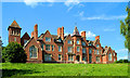
The Jarvis Charity School
George Jarvis, a Staunton boy, made very good in the City. When he died in 1793 he endowed almshouses and this grand building, once a boarding school. It was never a success and until recently part of it was used as the local primary school. The architects were Fulljames and Waller of Gloucester and it all dates from 1857-60. In addition there are grand detached houses in the neighbouring trees, originally for the senior staff of the school. Recent local news is that it has been sold and will re-open as a nursing home, thereby guaranteeing some sort of future for this remarkable building and its superb setting.
Image: © Philip Pankhurst
Taken: 22 Jun 2014
0.14 miles
7
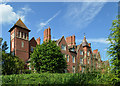
The Jarvis Charity
George Jarvis, a Staunton boy, made very good in the City. When he died in 1793 he endowed almshouses and this grand building, once a boarding school. It was never a success and until recently part of it was used as the local primary school. The architects were Fulljames and Waller of Gloucester and it all dates from 1857-60. In addition there are grand detached houses in the neighbouring trees, originally for the senior staff of the school. Recent local news is that it has been sold and will re-open as a nursing home, thereby guaranteeing some sort of future for this relatively unknown building and its superb setting.
Image: © Philip Pankhurst
Taken: 22 Jun 2014
0.14 miles
8
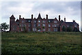
Former Staunton on Wye Youth Hostel
This building was originally a school. The huge red brick building that stands so prominently above the road to Hereford, was built in the 19th Century and was originally intended as a boarding school but was never successful.
Image: © Colin Park
Taken: 29 Aug 1982
0.14 miles
9
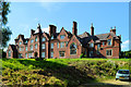
The Jarvis Charity School
George Jarvis, a Staunton boy, made very good in the City. When he died in 1793 he endowed almshouses and this grand building, once a boarding school. It was never a success and until recently part of it was used as the local primary school. The architects were Fulljames and Waller of Gloucester and it all dates from 1857-60. In addition there are grand detached houses in the neighbouring trees, originally for the senior staff of the school. Recent local news is that it has been sold and will re-open as a nursing home, thereby guaranteeing some sort of future for this relatively unknown but remarkable building and its superb setting.
Image: © Philip Pankhurst
Taken: 22 Jun 2014
0.15 miles