
IMAGES TAKEN NEAR TO
Brilley, Whitney-on-Wye, HEREFORD, HR3 6HA
Introduction
This page details the photographs taken nearby to HR3 6HA by members of the Geograph project.
The Geograph project started in 2005 with the aim of publishing, organising and preserving representative images for every square kilometre of Great Britain, Ireland and the Isle of Man.

There are currently over 7.5m images from over14,400 individuals and you can help contribute to the project by visiting https://www.geograph.org.uk
Image Map
Images are licensed for reuse under creativecommons.org/licenses/by-sa/2.0
Notes
- Clicking on the map will re-center to the selected point.
- The higher the marker number, the further away the image location is from the centre of the postcode.
Image Listing (9 Images Found)
Images are licensed for reuse under creativecommons.org/licenses/by-sa/2.0
Image
Details
Distance
1
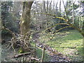
Wooded valley
West of Catworthy Court.
Image: © Jonathan Billinger
Taken: 26 Mar 2007
0.04 miles
2
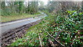
Snowdrops by the lane
Lane to the west of Catworthy Court.
Image: © Jonathan Billinger
Taken: 2 Feb 2016
0.07 miles
3
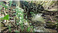
Snowdrops by a stream
Close-up of some of the plants seen in context; Image
Image: © Jonathan Billinger
Taken: 2 Feb 2016
0.07 miles
4
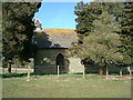
Bettws Clyro Church
This mediaeval church was rebuilt in 1878, maintaining its 14th century roof, carved figures and rood screen.
The diarist the Rev Francis Kilvert preached here.
Image: © Angela Jones
Taken: 17 Feb 2001
0.12 miles
5
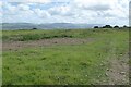
View to the Black Mountains
View to the Black Mountains from above Rhydspence.
Image: © Philip Halling
Taken: 11 Jun 2022
0.20 miles
6
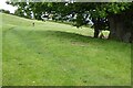
Walking Offa's Dyke Path
Walking Offa's Dyke Path above Rhydspence
Image: © Philip Halling
Taken: 11 Jun 2022
0.21 miles
7
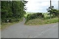
Road to Llwyngwilliam
The road to Llwyngwilliam is a private road to a farm but makes this road junction a crossroads. Offa's Dyke long distance footpath turns right at this junction. Unbeknown when taking this picture but it is a very similar view to the first picture uploaded in this grid square Image
Image: © Philip Halling
Taken: 11 Jun 2022
0.21 miles
8
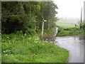
X roads near Penrhoel
The Offa's Dyke National Trail comes in on the lane from Clyro, then turns right towards Rhydspence as indicated by the sign in the photograph. The lane to the left is for Painscastle, while straight ahead in the access lane to Llwyngwilliam.
Image: © Chris Heaton
Taken: 15 May 2007
0.23 miles
9
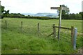
Footpath sign
Footpath sign on Offa's Dyke path.
Image: © Philip Halling
Taken: 11 Jun 2022
0.25 miles