
IMAGES TAKEN NEAR TO
Brobury, HEREFORD, HR3 6DX
Introduction
This page details the photographs taken nearby to HR3 6DX by members of the Geograph project.
The Geograph project started in 2005 with the aim of publishing, organising and preserving representative images for every square kilometre of Great Britain, Ireland and the Isle of Man.

There are currently over 7.5m images from over14,400 individuals and you can help contribute to the project by visiting https://www.geograph.org.uk
Image Map
Images are licensed for reuse under creativecommons.org/licenses/by-sa/2.0
Notes
- Clicking on the map will re-center to the selected point.
- The higher the marker number, the further away the image location is from the centre of the postcode.
Image Listing (9 Images Found)
Images are licensed for reuse under creativecommons.org/licenses/by-sa/2.0
Image
Details
Distance
1
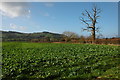
Farmland at Brobury
View west towards Bredwardine Hill.
Image: © Philip Halling
Taken: 20 Jan 2007
0.10 miles
2
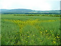
Last few rape flowers
Arable land west of Brobury. In the distance, beyond the Wye is the Moccas Hill/Woodbury Hill ridge.
Image: © Jonathan Billinger
Taken: 10 Jun 2009
0.12 miles
3
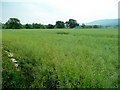
Arable at New Court, Brobury
Oaker's Hill in the distance.
Image: © Jonathan Billinger
Taken: 10 Jun 2009
0.13 miles
4
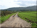
Farmland at Brobury
Taken from the Wye Valley Walk. Moccas Park, on the other side of the river, is heavily wooded.
Image: © David Purchase
Taken: 17 Oct 2013
0.17 miles
5
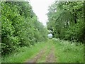
Track, New Court
An old sign lies on the ground nearby, this could be a replaced access road.
Image: © Richard Webb
Taken: 23 May 2022
0.18 miles
6
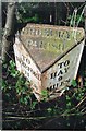
Old Milepost near New Court, Brobury with Monnington on Wye parish
Cast iron post by the UC road, in parish of BROBURY WITH MONNINGTON ON WYE (District), opposite entrance to New Court, Brobury, by the road, on Northwest side of road. Hodges iron T-post, erected by the Hereford turnpike trust in the 19th century.
Inscription reads:-
: TO / HEREFORD / 11 / MILES : : BROBURY / PARISH : : TO / HAY / 9 / MILES :
Maker:-
: C. HODGES & SON / HEREFORD / FOUNDRY 1849 :
Herefordshire SMR.
SMR Number: 56666 https://www.heritagegateway.org.uk/Gateway/Results_Single.aspx?uid=MHE28422&resourceID=101
Milestone Society National ID: HF_HYHF09A.
Image: © J Higgins
Taken: 1 Oct 2006
0.23 miles
7
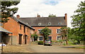
Old Court, Brobury
Brick house of around 1800, but with 17th century core. The remotest of settings, next to the former church.
Image: © Philip Pankhurst
Taken: 21 Jun 2013
0.23 miles
8
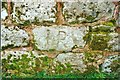
Church Boundary Wall Graffiti
In the boundary wall of the Former Parish Church at Brobury is this Graffiti. The Church is now a private dwelling.
Image: © paul wood
Taken: 30 Oct 2003
0.23 miles
9
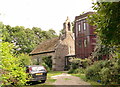
Magdalen, Brobury
The former church of St Mary Magdalene, converted to a house in 1982.
Image: © Philip Pankhurst
Taken: 21 Jun 2013
0.24 miles