
IMAGES TAKEN NEAR TO
Snodhill, Dorstone, HEREFORD, HR3 6BG
Introduction
This page details the photographs taken nearby to HR3 6BG by members of the Geograph project.
The Geograph project started in 2005 with the aim of publishing, organising and preserving representative images for every square kilometre of Great Britain, Ireland and the Isle of Man.

There are currently over 7.5m images from over14,400 individuals and you can help contribute to the project by visiting https://www.geograph.org.uk
Image Map
Images are licensed for reuse under creativecommons.org/licenses/by-sa/2.0
Notes
- Clicking on the map will re-center to the selected point.
- The higher the marker number, the further away the image location is from the centre of the postcode.
Image Listing (99 Images Found)
Images are licensed for reuse under creativecommons.org/licenses/by-sa/2.0
Image
Details
Distance
1
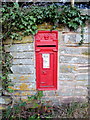
Victorian postbox at Snodhill
Framed by ivy on a stone wall.
Image: © Jonathan Billinger
Taken: 28 Dec 2011
0.03 miles
3
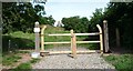
Entrance Gates to Snodhill Castle
These recently added-on entrance gates to Snodhill Castle leads the visitor to the remains of Snodhill Castle, and in my opinion, these look very nice. On the bottom of the left pole lies a box, where they have information sheets inside about the castle.
Image: © Fabian Musto
Taken: 23 Jun 2018
0.09 miles
4
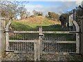
Entrance gates to Snodhill Castle
These wooden entrance gates date from 2017, during the time the castle was restored. An information board can be seen to the right, which wasn't there when I first visited in June 2018.
Image: © Fabian Musto
Taken: 3 Feb 2022
0.10 miles
5
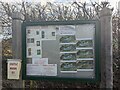
Information board at Snodhill Castle
This information board was installed in 2021 or between 2018-20. The board highlights a few structures in the area that is unknown to people, and they featured a useful evolution collection of Snodhill Castle (seven pictures). The Snodhill Castle Preservation Trust informs people to stick to the safety measurements, keep dogs under control and emergency information.
Image: © Fabian Musto
Taken: 3 Feb 2022
0.10 miles
6

Farm by Snodhill Castle
Nearby to the remains of Snodhill Castle lies this farm, which is blocked by a gate. Some sheep were in the distance.
Image: © Fabian Musto
Taken: 23 Jun 2018
0.11 miles
7
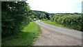
The Castle (Snodhill)
"The Castle" is a lane that goes around the outskirts of the remains of Snodhill Castle. This is viewed from the small carpark that leads to the castle remains.
Image: © Fabian Musto
Taken: 23 Jun 2018
0.11 miles
8
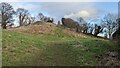
Snodhill Castle
Here are the grade II* listed remains of Snodhill Castle in the parish of Peterchurch, which was first built of stone in the mid 12th century. The castle existed here for half a millennium until it was sieged in the English Civil War around 1650. The ruins were overgrown with many trees in the area when it was given listed status in January 1949, and it wasn't until 2016 when the Snodhill Castle Preservation Trust saved the site from further destruction. The site opened to the public in late May 2018, and I visited the area in June 2018 when the area was still being restored.
Image: © Fabian Musto
Taken: 3 Feb 2022
0.11 miles
9
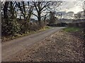
The Castle (Snodhill)
This lane goes around the earthworks of Snodhill Castle, hence its name.
Image: © Fabian Musto
Taken: 3 Feb 2022
0.11 miles
10
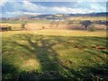
Farmland north of Snodhill
View north across the Golden Valley towards Dorstone.
Image: © Trevor Rickard
Taken: 10 Feb 2010
0.12 miles