
IMAGES TAKEN NEAR TO
Dorstone, HEREFORD, HR3 6AN
Introduction
This page details the photographs taken nearby to HR3 6AN by members of the Geograph project.
The Geograph project started in 2005 with the aim of publishing, organising and preserving representative images for every square kilometre of Great Britain, Ireland and the Isle of Man.

There are currently over 7.5m images from over14,400 individuals and you can help contribute to the project by visiting https://www.geograph.org.uk
Image Map
Images are licensed for reuse under creativecommons.org/licenses/by-sa/2.0
Notes
- Clicking on the map will re-center to the selected point.
- The higher the marker number, the further away the image location is from the centre of the postcode.
Image Listing (131 Images Found)
Images are licensed for reuse under creativecommons.org/licenses/by-sa/2.0
Image
Details
Distance
1
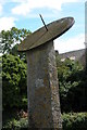
Sundial in the village of Dorstone
Sundial on a small village green in Dorstone.
Image: © Philip Halling
Taken: 29 Aug 2005
0.01 miles
2
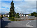
Building site in Dorstone
Located in the centre of the village, opposite the Pandy Inn. http://www.geograph.org.uk/photo/3136499
Image: © Jaggery
Taken: 16 Sep 2012
0.01 miles
3

Village Sundial, Dorstone
The medieval village cross shaft had a sundial fitted to it in 1812. Easily read from the first floor windows of the adjacent cottage or by passing giants.
Image: © Philip Pankhurst
Taken: 21 Jun 2013
0.01 miles
4
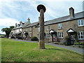
Cross Shaft Sundial on Village Green (Dorstone)
The cross shaft may date from the 15th century, and might have had a cross on top of this back then, until in 1812, a sundial was placed on top of it. A very unusual sight, but impressive.
Image: © Fabian Musto
Taken: 23 Jun 2018
0.01 miles
5
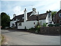
The Pandy Inn (Dorstone)
Said to have been the oldest public house in Herefordshire and dating from 1185, this is the only pub in Dorstone that is still open by today, as you can see here.
Image: © Fabian Musto
Taken: 23 Jun 2018
0.01 miles
6
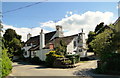
The Pandy Inn, Dorstone
Fabled hostelry in this Golden Valley village.
Image: © Philip Pankhurst
Taken: 21 Jun 2013
0.01 miles
7
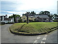
The Village of Dorstone
Here is the village of Dorstone, viewed from the starting/ending point of Church Road. The Village Hall and Pandy Inn buildings can be seen from here.
Image: © Fabian Musto
Taken: 23 Jun 2018
0.01 miles
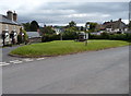
9
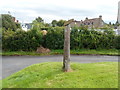
Cross shaft and sundial, Dorstone
Located on the NE side of the village green. http://www.geograph.org.uk/photo/3136307
The stone cross shaft may date from the 15th century. The cast iron sundial was added in 1812. Whether the stone cross previously at the top of the shaft was removed, or had already broken off, is unknown to this contributor.
Image: © Jaggery
Taken: 16 Sep 2012
0.01 miles
10
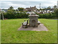
Middle of the village green, Dorstone
In the middle of the green is a stone structure inside which is a tap above a circular drain.
There are stone benches on two sides of the structure, and a wooden bench at another side.
In the background on the left is a sundial on a cross shaft. http://www.geograph.org.uk/photo/3136583
Image: © Jaggery
Taken: 16 Sep 2012
0.02 miles