
IMAGES TAKEN NEAR TO
Dore View, HEREFORD, HR3 6AJ
Introduction
This page details the photographs taken nearby to Dore View, HR3 6AJ by members of the Geograph project.
The Geograph project started in 2005 with the aim of publishing, organising and preserving representative images for every square kilometre of Great Britain, Ireland and the Isle of Man.

There are currently over 7.5m images from over14,400 individuals and you can help contribute to the project by visiting https://www.geograph.org.uk
Image Map
Images are licensed for reuse under creativecommons.org/licenses/by-sa/2.0
Notes
- Clicking on the map will re-center to the selected point.
- The higher the marker number, the further away the image location is from the centre of the postcode.
Image Listing (114 Images Found)
Images are licensed for reuse under creativecommons.org/licenses/by-sa/2.0
Image
Details
Distance
1

B4348, Dorstone
The B4348 is the main road through the village, or rather, through the northern edge of the village.
This view is looking west.
Image: © Jaggery
Taken: 16 Sep 2012
0.03 miles
2

Well in Dorstone
The Herefordshire Council notice on the well wall shows that the water in the well is unsuitable for drinking unless boiled.
Image: © Jaggery
Taken: 16 Sep 2012
0.03 miles
3

Western boundary of Dorstone
The road into the village heads away from the B4348.
The village of Dorstone, population c200, is in the Golden Valley, western Herefordshire.
Image: © Jaggery
Taken: 16 Sep 2012
0.05 miles
4
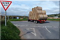
Hay trailer at the edge of Dorstone
Viewed from a grassy bank, near the village's western boundary sign. http://www.geograph.org.uk/photo/3135885
The trailer, drawn by a tractor, is at the B4348 crossroads.
Image: © Jaggery
Taken: 16 Sep 2012
0.08 miles
5
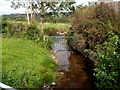
Brook viewed from Brookland Bridge, Dorstone
Pont-y-Weston Brook is a tributary of the River Dore.
Image: © Jaggery
Taken: 16 Sep 2012
0.08 miles
6

Unknown House (Dorstone)
Sadly, there isn't much information about this building, and I couldn't get the name too, but this unknown building is actually one of my most favourite buildings in Dorstone! This is viewed from Pont-y-Weston Bridge. This might be a farmhouse, but who knows.
Image: © Fabian Musto
Taken: 23 Jun 2018
0.08 miles
7

Field to the west of Dorstone
Viewed from near the western boundary http://www.geograph.org.uk/photo/3135885 of Dorstone.
Image: © Jaggery
Taken: 16 Sep 2012
0.08 miles
8
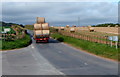
Harvest time near Dorstone
This mid-September view shows rolls of harvested hay on the right, and a trailerful of hay
being drawn by a tractor on the B4348 a little west of the western edge of Dorstone.
Image: © Jaggery
Taken: 16 Sep 2012
0.09 miles
9

Pont-y-Weston Bridge (Dorstone)
I just gave this bridge the name I put in the title. Anyways, this miniature bridge goes over the Pont-y-Weston brook and then you get a view of this interesting building: Image . Dorstone Castle is nearby.
Image: © Fabian Musto
Taken: 23 Jun 2018
0.09 miles
10

Dorstone Castle
Here is the castle motte at Dorstone, which you can view by taking the "Dorstone Footpath" track.
Image: © Fabian Musto
Taken: 23 Jun 2018
0.11 miles