
IMAGES TAKEN NEAR TO
Brecon Road, HEREFORD, HR3 5PJ
Introduction
This page details the photographs taken nearby to Brecon Road, HR3 5PJ by members of the Geograph project.
The Geograph project started in 2005 with the aim of publishing, organising and preserving representative images for every square kilometre of Great Britain, Ireland and the Isle of Man.

There are currently over 7.5m images from over14,400 individuals and you can help contribute to the project by visiting https://www.geograph.org.uk
Image Map
Images are licensed for reuse under creativecommons.org/licenses/by-sa/2.0
Notes
- Clicking on the map will re-center to the selected point.
- The higher the marker number, the further away the image location is from the centre of the postcode.
Image Listing (46 Images Found)
Images are licensed for reuse under creativecommons.org/licenses/by-sa/2.0
Image
Details
Distance
3
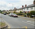
Oakland Villas, Hay-on-Wye
Located on Brecon Road.
Image: © Jaggery
Taken: 30 Jun 2010
0.06 miles
4
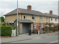
Old-style communications centre, Hay-on-Wye
If those newfangled inventions, email and the Internet, are not for you, then this collection of alternative methods of communication, located on the side of Brecon Road, may be to your liking. You have the choice of a phone box, post box , or can wait here for the next bus, while you discard your junk mail in the receptacle provided.
Image: © Jaggery
Taken: 30 Jun 2010
0.06 miles
5
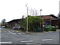
Industrial estate
Off the B4350 to the west of Hay.
Image: © Jonathan Billinger
Taken: 19 Jan 2007
0.06 miles
6
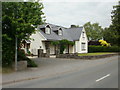
Springfield, Brecon Road, Hay-on-Wye
House located on the north side of Brecon Road, between Oakland Villas and Wye Valley Business Park.
Image: © Jaggery
Taken: 30 Jun 2010
0.08 miles
7
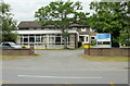
Cartref Residential Home, Hay-on-Wye
Located on Brecon Road, opposite the fire station. http://www.geograph.org.uk/photo/1957463
The private care home caters for 22 residents.
Image: © Jaggery
Taken: 30 Jun 2010
0.11 miles
8
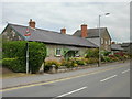
Former almshouses, Brecon Road, Hay-on-Wye
19th century building on Brecon Road, about 200 metres from another row of almshouses http://www.geograph.org.uk/photo/1956642 on Church Road. The taller central section was added in 1927.
Image: © Jaggery
Taken: 30 Jun 2010
0.11 miles
9
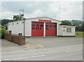
Hay-on-Wye Fire Station
Located on Brecon Road.
The Fire Brigade was formed in Hay-on-Wye under the old local government board in 1892.
The present-day fire station is part of Mid and West Wales Fire and Rescue Service, which is responsible for 4,500 square miles, or roughly two-thirds, of Wales.
Image: © Jaggery
Taken: 30 Jun 2010
0.11 miles
10
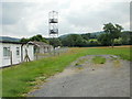
Training tower, Hay-on-Wye Fire Station
Located on the edge of fields, beside the fire station. http://www.geograph.org.uk/photo/1957463
Image: © Jaggery
Taken: 30 Jun 2010
0.11 miles