
IMAGES TAKEN NEAR TO
Hardwicke, Hay-on-Wye, HEREFORD, HR3 5HA
Introduction
This page details the photographs taken nearby to HR3 5HA by members of the Geograph project.
The Geograph project started in 2005 with the aim of publishing, organising and preserving representative images for every square kilometre of Great Britain, Ireland and the Isle of Man.

There are currently over 7.5m images from over14,400 individuals and you can help contribute to the project by visiting https://www.geograph.org.uk
Image Map
Images are licensed for reuse under creativecommons.org/licenses/by-sa/2.0
Notes
- Clicking on the map will re-center to the selected point.
- The higher the marker number, the further away the image location is from the centre of the postcode.
Image Listing (8 Images Found)
Images are licensed for reuse under creativecommons.org/licenses/by-sa/2.0
Image
Details
Distance
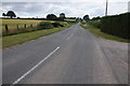
2
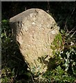
Old Boundary Marker on the B4352 in Clifford parish
Parish Boundary Marker on the south side of the B4352 at Pen-y-Park, east of the hill top and cottages and east of milestone HF_HYHF03. Clifford parish. Inscribed but illegible.
Herefordshire SMR. SMR Number: 56797 https://www.heritagegateway.org.uk/Gateway/Results_Single.aspx?uid=MHE28552&resourceID=101
Milestone Society National ID: HF_HYHF03pb
Image: © M Faherty
Taken: 8 Apr 2010
0.08 miles
3
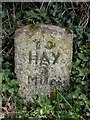
Old Milestone, B4352, Pen-y-Park
The milestone is located at the top of East Hill, east of cottages, on the verge immediately to the west of the boundary marker HF_HYHF03pb https://www.geograph.org.uk/photo/6049297 on the south side of the road. Parish of Clifford (Hererfordshire District). Carved stone post, erected by the Whitney & Brewardine turnpike trust in the 19th century.
Inscription reads:- : TO / HAY / 3 MILES :
Milestone Society National ID: HF_HYHF03
Image: © Mike Faherty
Taken: 8 Apr 2010
0.08 miles
5
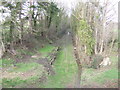
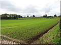
Golden Valley Line - north
This view is from the same point on the B4352 as Image, looking north. This was the site of Greens Siding station closed 15 December 1941. The remains of the platform can just be made out.
Image: © Jonathan Billinger
Taken: 19 Jan 2007
0.19 miles

7
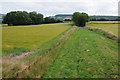
Trackbed of the old Golden Valley line
Trackbed of the old Golden Valley line which used to run from Pontrialas to Hay-on-Wye. The line had a checkered history and originally closed in 1898 after running into financial difficulties; it was bought and reopened by the Great Western Railway in 1901. The line finally closed pre-Beeching in 1957.
Image: © Philip Halling
Taken: 20 Jul 2013
0.20 miles
8
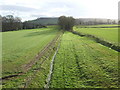
Golden Valley Line
This small line formed a link between Pontrilas and Hay and was built in the late 19th century. It closed in 1957.
See: http://www.smr.herefordshire.gov.uk/post-medieval/railways/golden_valley
Image: © Jonathan Billinger
Taken: 19 Jan 2007
0.23 miles