
IMAGES TAKEN NEAR TO
Clehonger, HEREFORD, HR2 9TL
Introduction
This page details the photographs taken nearby to HR2 9TL by members of the Geograph project.
The Geograph project started in 2005 with the aim of publishing, organising and preserving representative images for every square kilometre of Great Britain, Ireland and the Isle of Man.

There are currently over 7.5m images from over14,400 individuals and you can help contribute to the project by visiting https://www.geograph.org.uk
Image Map
Images are licensed for reuse under creativecommons.org/licenses/by-sa/2.0
Notes
- Clicking on the map will re-center to the selected point.
- The higher the marker number, the further away the image location is from the centre of the postcode.
Image Listing (18 Images Found)
Images are licensed for reuse under creativecommons.org/licenses/by-sa/2.0
Image
Details
Distance

2
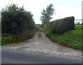
Unsuitable lane for long or wide vehicles, Clehonger
The lane gives the shortest route to Madley from the western edge of Clehonger,
but is not suitable for long or wide vehicles.
Image: © Jaggery
Taken: 26 Aug 2012
0.11 miles
3
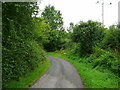
Mill Lane, Clehonger
Beware - the lane gets very narrow past the New Mill on the Cage Brook, just around this bend.
Image: © Jonathan Billinger
Taken: 31 Jul 2008
0.13 miles
4
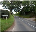
Western boundary of Clehonger
The B4349 from Kingstone reaches Clehonger, a large village in SW Herefordshire, about 7km from Hereford. Research for the origin of the name Clehonger has so far proved fruitless.
Image: © Jaggery
Taken: 26 Aug 2012
0.13 miles
6
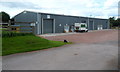
Industrial units, Smallbrook Farm, Clehonger
There are 4 industrial units in this row. On the left in Unit 1 is GoodWood Garden Buildings Limited.
Image: © Jaggery
Taken: 26 Aug 2012
0.14 miles
7
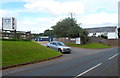
Entrance to Smallbrook Farm near Clehonger
Viewed from the B4349. Notices show that a room and storage units (trade or domestic) are to let.
Image: © Jaggery
Taken: 26 Aug 2012
0.15 miles
8

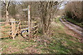
Public footpath and lane at Littlemarsh Common
Image: © Rob Purvis
Taken: 29 May 2025
0.16 miles
9
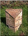
Old Milestone, B4349, near Bowley Farm, Clehonger
The milestone is located on the verge, on the north side of the road. Parish of Clehonger (Herefordshire District). Cast iron post, Hereford iron T-post design, erected by the Hereford turnpike trust in the 19th century.
Inscription reads:-
TO / HEREFORD / 5 / MILES : : CLEHONGER / PARISH : : TO / PETERCHUrch / 7 / MILES
Milestone Society National ID: HF_HFPC05
Image: © M Faherty
Taken: 17 Mar 2008
0.16 miles
10
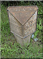
Old Milestone, B4349, near Bowley Farm, Clehonger
The milestone is located on the verge, on the north side of the road. Parish of Clehonger (Herefordshire District). Cast iron post, Hereford iron T-post design, erected by the Hereford turnpike trust in the 19th century.
Inscription reads:-
TO / HEREFORD / 5 / MILES : : CLEHONGER / PARISH : : TO / PETERCHUrch / 7 / MILES
Milestone Society National ID: HF_HFPC05
Image: © Roadside Relics
Taken: 5 Jul 2021
0.16 miles