1
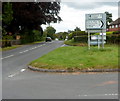
Stile and footpath signs, Clehonger
Footpaths to Ruckhall and Abbey Farm
Image: © Philip Halling
Taken: 8 Apr 2006
0.03 miles
2
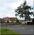
The B4349 passing through Clehonger
The B4349 through Clehonger
Image: © Philip Halling
Taken: 8 Apr 2006
0.03 miles
3
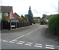
Village Hall, Clehonger
Set back 60 metres from the east side of Birch Hill Road, near the B4349.
Image: © Jaggery
Taken: 26 Aug 2012
0.03 miles
4
Intersection of Gosmore Road and Birch Hill Road, Clehonger
Viewed along Gosmore Road across Birch Hill Road.
Image: © Jaggery
Taken: 26 Aug 2012
0.07 miles
5
Birch Hill Road, Clehonger
A view SSE across Gosmore Road. Something has bent the street name sign on the right such that only BIRCH H is visible in this view.
Image: © Jaggery
Taken: 26 Aug 2012
0.12 miles
6
B4349 approaches B4352 junction in Clehonger
Located at the northern edge of the village.
Image: © Jaggery
Taken: 26 Aug 2012
0.13 miles
7
Distances from Clehonger
The course of the B4349 turns through 90 degrees here, at the junction with the B4352 which ends here. Distances shown along the B4349 are 4 (miles) to Hereford (eastwards). Southwards, it's 2 to Kingstone, 7 to Peterchurch and 16 to Hay-on-Wye.
Image: © Jaggery
Taken: 26 Aug 2012
0.13 miles
8
Junction of the B4349 and B4352 in Clehonger
Though traffic on the camera side, on the B4349, has to give way to traffic on the B4352, this point marks the eastern end of the B4352. The road on the right, to Hereford, is the B4349. Signs show 4 (miles) to Hereford, and in the opposite direction 2 to Madley, 6 to Blakemere and 9 to Bredwardine.
Image: © Jaggery
Taken: 26 Aug 2012
0.14 miles
9
Birch Meadow, Clehonger
A residential cul-de-sac viewed from Gosmore Road.
Image: © Jaggery
Taken: 26 Aug 2012
0.17 miles
10
The Seven Stars near Clehonger
Viewed across the B4349.
The pub has a Petanque Club and an outdoor area http://www.geograph.org.uk/photo/3646411 where French boules can be played.
Image: © Jaggery
Taken: 26 Aug 2012
0.19 miles


