
IMAGES TAKEN NEAR TO
Madley, HEREFORD, HR2 9NR
Introduction
This page details the photographs taken nearby to HR2 9NR by members of the Geograph project.
The Geograph project started in 2005 with the aim of publishing, organising and preserving representative images for every square kilometre of Great Britain, Ireland and the Isle of Man.

There are currently over 7.5m images from over14,400 individuals and you can help contribute to the project by visiting https://www.geograph.org.uk
Image Map
Images are licensed for reuse under creativecommons.org/licenses/by-sa/2.0
Notes
- Clicking on the map will re-center to the selected point.
- The higher the marker number, the further away the image location is from the centre of the postcode.
Image Listing (39 Images Found)
Images are licensed for reuse under creativecommons.org/licenses/by-sa/2.0
Image
Details
Distance
2
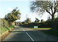
Approach to Madley
Approaching Madley on the B4352, adjacent to the Danmek Nursery
Image: © Alan Spencer
Taken: 5 Nov 2009
0.10 miles
3
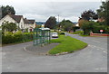
Bus shelter and turning point, Archenfield, Madley
This bus stop is the point where buses on service 39/39A Brecon-Hereford and Hereford-Brecon turn around, near the western edge of Madley. To reach Madley, the buses have made a westerly diversion from the main route, and now return eastwards to that route.
Image: © Jaggery
Taken: 2 Sep 2012
0.10 miles
4
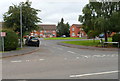
Tinglebrook Close, Madley
Tinglebrook Close is a cul-de-sac of 19 houses on the north side of the B4352.
A faded sign on the left shows
PRIVATE
RESIDENTS
ONLY.
Image: © Jaggery
Taken: 2 Sep 2012
0.11 miles
5
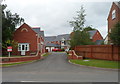
Seabourne Gardens, Madley
A cul-de-sac on the north side of the B4352.
Image: © Jaggery
Taken: 2 Sep 2012
0.12 miles
6
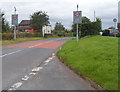
Speed limit 20 when lights flash, Madley
The signs are located on the approach to Madley Primary School.
Image: © Jaggery
Taken: 2 Sep 2012
0.13 miles
7
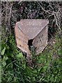
Old Milepost by the B4352, near Showel Farm, Madley parish
Cast iron post by the B4352, in parish of MADLEY (District), Showel Farm; opposite nursery, on the verge, on North side of road. Hereford iron T-post, erected by the Hereford turnpike trust in the 19th century. Broken.
Inscription reads:-
: TO / HEREFO(RD) / 7 / MILES : : MADLEY / PARISH : : TO / HAY / 15 / (M)ILES :
Herefordshire SMR listed.
SMR Number: 56669 https://www.heritagegateway.org.uk/Gateway/Results_Single.aspx?uid=MHE28425&resourceID=101
Milestone Society National ID: HF_HYHF15.
Image: © M Faherty
Taken: 8 Apr 2010
0.14 miles
8
Madley Village playing field
Football pitch Madley playing field
Image: © Alan Spencer
Taken: 29 Sep 2009
0.18 miles
9
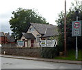
A B4352 road junction, Madley
Viewed from the corner of the road http://www.geograph.org.uk/photo/3111867 from Lulham and Bridge Sollers.
Turn left for Hereford or Clehonger; right for Hay-on-Wye, Bredwardine, Blakemere or Tyberton. The Ty of Tyberton is no longer on the sign.
Madley parish hall http://www.geograph.org.uk/photo/3111897 is in the background.
Image: © Jaggery
Taken: 2 Sep 2012
0.18 miles
10
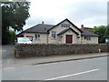
Madley Parish Hall
Located on the south side of the B4352, the parish hall was built in 1929 on land owned by the Church of England and funded by subscription from the people of Madley. Later refurbishments and an extension were undertaken, resulting in the largest parish hall within a 15 mile radius. There are facilities such as a large auditorium with stage, and a kitchen, bar and toilet block.
Many community activities take place here. Examples are pre-school once a week; day centre for the elderly; Short Mat Bowls; various society and club meetings; local medical care; parish and other meetings; entertainments such as bingo; farmers markets for display and sale of local produce. Occasional users of the parish hall are Herefordshire Council, for elections (local, general and EEC (European)). The parish hall can be rented for birthday and other celebrations.
Image: © Jaggery
Taken: 2 Sep 2012
0.18 miles