
IMAGES TAKEN NEAR TO
Wormbridge, HEREFORD, HR2 9EH
Introduction
This page details the photographs taken nearby to HR2 9EH by members of the Geograph project.
The Geograph project started in 2005 with the aim of publishing, organising and preserving representative images for every square kilometre of Great Britain, Ireland and the Isle of Man.

There are currently over 7.5m images from over14,400 individuals and you can help contribute to the project by visiting https://www.geograph.org.uk
Image Map
Images are licensed for reuse under creativecommons.org/licenses/by-sa/2.0
Notes
- Clicking on the map will re-center to the selected point.
- The higher the marker number, the further away the image location is from the centre of the postcode.
Image Listing (13 Images Found)
Images are licensed for reuse under creativecommons.org/licenses/by-sa/2.0
Image
Details
Distance
1
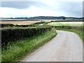
Winding road in the Grey Valley
Just north of Crossway Cottage.
Image: © Oliver Dixon
Taken: 6 Sep 2020
0.06 miles
2
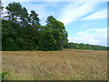
Edge of Blackmoor Plantation
View north from the byway in Image
Image: © Jonathan Billinger
Taken: 18 Aug 2008
0.13 miles
3
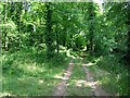
Woodland track
Through Blackmoor Plantation
Image: © Hugh Venables
Taken: 12 Jul 2006
0.13 miles
4
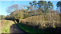
Track and byway
Entering the woods of Brampton Hill.
Image: © Jonathan Billinger
Taken: 23 Dec 2015
0.14 miles
5
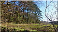
Edge of Blackmoor Plantation
A young cereal crop in the foreground.
Image: © Jonathan Billinger
Taken: 23 Dec 2015
0.14 miles
6
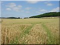
More ripening crops
With woodland on the steeper slopes in the valley - generally that or grazing, with arable crops on the valley floor.
Image: © Hugh Venables
Taken: 12 Jul 2006
0.14 miles
7
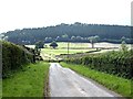
Descent into the Grey Valley
Dunseal Wood Image on the far side.
Image: © Oliver Dixon
Taken: 6 Sep 2020
0.14 miles
8
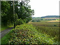
Lane south of Brampton Hill
Next to a field of fodder beans and Blackmoor Plantation.
Image: © Jonathan Billinger
Taken: 18 Aug 2008
0.17 miles
9
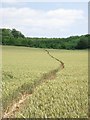
Path through crop
Good to see a clear path - often not the case round here.
Image: © Hugh Venables
Taken: 12 Jul 2006
0.18 miles
10
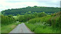
Stone Street by Blackmoor farm
The line of an obscure Roman Road leads the eye towards the coniferous slopes of Dunseal Wood backlit by spring sunshine.
Image: © Jonathan Billinger
Taken: 26 May 2015
0.18 miles