
IMAGES TAKEN NEAR TO
St. Weonards, HEREFORD, HR2 8QQ
Introduction
This page details the photographs taken nearby to HR2 8QQ by members of the Geograph project.
The Geograph project started in 2005 with the aim of publishing, organising and preserving representative images for every square kilometre of Great Britain, Ireland and the Isle of Man.

There are currently over 7.5m images from over14,400 individuals and you can help contribute to the project by visiting https://www.geograph.org.uk
Image Map
Images are licensed for reuse under creativecommons.org/licenses/by-sa/2.0
Notes
- Clicking on the map will re-center to the selected point.
- The higher the marker number, the further away the image location is from the centre of the postcode.
Image Listing (6 Images Found)
Images are licensed for reuse under creativecommons.org/licenses/by-sa/2.0
Image
Details
Distance
1
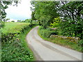
Lane at Trolway
Heading north from Garway towards Treferanon.
Image: © Jonathan Billinger
Taken: 8 Jun 2010
0.02 miles
2
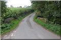
Bridge near Trolway
View looks northwards on the lane between Garway and Orcop.
Image: © Roger Davies
Taken: 24 Sep 2010
0.03 miles
3
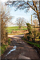
Country Road, Trolway
Though not obvious in the picture, the road goes over a small stream here. The road on the right leads up to the village of Garway.
Image: © Stuart Wilding
Taken: 7 Mar 2021
0.04 miles
4
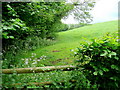
Pasture land at Trolway
Alongside a tributary of the Garren Brook.
Image: © Jonathan Billinger
Taken: 8 Jun 2010
0.08 miles
5
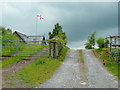
St. George's flag aloft
A show of support for England's forthcoming efforts in South Africa 2010.
Image: © Jonathan Billinger
Taken: 8 Jun 2010
0.10 miles
6
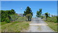
Double gates
See my picture of almost exactly five years earlier; the flag is now a Union Jack; Image
Image: © Jonathan Billinger
Taken: 16 Jun 2015
0.12 miles