
IMAGES TAKEN NEAR TO
Garway Hill, HEREFORD, HR2 8EY
Introduction
This page details the photographs taken nearby to HR2 8EY by members of the Geograph project.
The Geograph project started in 2005 with the aim of publishing, organising and preserving representative images for every square kilometre of Great Britain, Ireland and the Isle of Man.

There are currently over 7.5m images from over14,400 individuals and you can help contribute to the project by visiting https://www.geograph.org.uk
Image Map
Images are licensed for reuse under creativecommons.org/licenses/by-sa/2.0
Notes
- Clicking on the map will re-center to the selected point.
- The higher the marker number, the further away the image location is from the centre of the postcode.
Image Listing (7 Images Found)
Images are licensed for reuse under creativecommons.org/licenses/by-sa/2.0
Image
Details
Distance
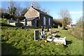
2
Garway Hill Methodist Chapel
This chapel was the subject of the first picture uploaded in this grid square which I took on New Year's Eve in 2005 Image I have tried to recreate this but it is a slightly different viewpoint due to the low January sun.
Image: © Philip Halling
Taken: 30 Jan 2023
0.04 miles
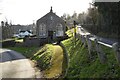
3

Garway Hill Methodist Church
The Garway Hill Methodist Chapel was built in 1860, with its opening date recorded as September 30, 1860.
Image: © Stuart Wilding
Taken: 22 Oct 2025
0.04 miles
4
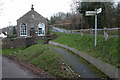
Chapel at Garway Hill
Chapel in the village below Garway Hill
Image: © Philip Halling
Taken: 31 Dec 2005
0.06 miles
5
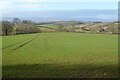
Farmland below Garway Hill
Farmland below Garway Hill near Bagwyllydiart.
Image: © Philip Halling
Taken: 30 Jan 2023
0.14 miles
6
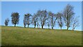
Trees on the horizon
Trees on the horizon on Garway Hill.
Image: © Philip Halling
Taken: 30 Jan 2023
0.21 miles
7

View towards the Black Mountains
In the distance can be seen Hay Bluff.
Image: © Stuart Wilding
Taken: 6 Jul 2014
0.24 miles