
IMAGES TAKEN NEAR TO
Wormelow, HEREFORD, HR2 8EG
Introduction
This page details the photographs taken nearby to HR2 8EG by members of the Geograph project.
The Geograph project started in 2005 with the aim of publishing, organising and preserving representative images for every square kilometre of Great Britain, Ireland and the Isle of Man.

There are currently over 7.5m images from over14,400 individuals and you can help contribute to the project by visiting https://www.geograph.org.uk
Image Map
Images are licensed for reuse under creativecommons.org/licenses/by-sa/2.0
Notes
- Clicking on the map will re-center to the selected point.
- The higher the marker number, the further away the image location is from the centre of the postcode.
Image Listing (9 Images Found)
Images are licensed for reuse under creativecommons.org/licenses/by-sa/2.0
Image
Details
Distance
1
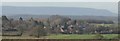
The Village of Much Dewchurch
The Black Mountains are seen in the background, and the bell tower of St. David's is seen in the bottom-left.
Image: © Fabian Musto
Taken: 18 Jan 2020
0.05 miles
2
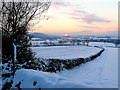
Snowy footpath
Looking south-west from the A466 at King's Thorn.
A wintery sunset in view, Orcop Hill to the left.
Image: © Jonathan Billinger
Taken: 8 Jan 2010
0.10 miles
3
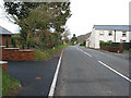
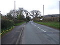
Road through King's Thorn
A post office is marked on my map, but nowhere to be seen. The white house could be the former post office as there is a postbox in the wall. Let me know if this is so. The wooded, lower slopes of Aconbury Hill can be seen in the distance.
Image: © Pauline E
Taken: 22 Jan 2008
0.16 miles
4
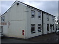
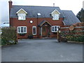
Houses, King's Thorn
Showing position of Postbox No. HR2 247.
See Image] for postbox.
Image: © JThomas
Taken: 4 Apr 2019
0.16 miles
5
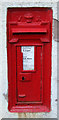
Victorian postbox, King's Thorn
Postbox No. HR2 247.
See Image] for context.
Image: © JThomas
Taken: 4 Apr 2019
0.17 miles
8
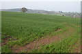
Field of winter Cereal, King's Thorn
Field viewed from just north of Tabor Court, the village of King's Thorn can be seen in the background.
Image: © Philip Halling
Taken: 22 Apr 2006
0.21 miles
9
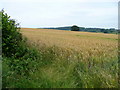
Wheat field south of King's Thorn 1
Looking north-east towards Aconbury Hill.
Image: © Jonathan Billinger
Taken: 31 Jul 2008
0.23 miles