
IMAGES TAKEN NEAR TO
Callow View, HEREFORD, HR2 8DY
Introduction
This page details the photographs taken nearby to Callow View, HR2 8DY by members of the Geograph project.
The Geograph project started in 2005 with the aim of publishing, organising and preserving representative images for every square kilometre of Great Britain, Ireland and the Isle of Man.

There are currently over 7.5m images from over14,400 individuals and you can help contribute to the project by visiting https://www.geograph.org.uk
Image Map
Images are licensed for reuse under creativecommons.org/licenses/by-sa/2.0
Notes
- Clicking on the map will re-center to the selected point.
- The higher the marker number, the further away the image location is from the centre of the postcode.
Image Listing (118 Images Found)
Images are licensed for reuse under creativecommons.org/licenses/by-sa/2.0
Image
Details
Distance
1
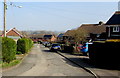
Church View, Much Dewchurch
Houses at the southeast edge of the village, viewed from near the corner of the B4348.
A nearby sign shows that Church View leads to houses in Callow View.
Image: © Jaggery
Taken: 13 Mar 2016
0.06 miles
2
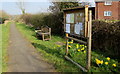
Parish noticeboard, bench and daffodils, Much Dewchurch
Alongside a path at the edge of the B4348 in the southeast of the village. The dedication on the bench is
IN MEMORY OF PHILIP TURPIN WHO DID SUCH A LOT FOR THIS VILLAGE.
The year MMIX (2009) is inscribed on the side of the bench.
Image: © Jaggery
Taken: 13 Mar 2016
0.07 miles
3
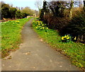
Pathside daffodils, Much Dewchurch
The path is alongside the B4348. Viewed in mid March 2016.
Image: © Jaggery
Taken: 13 Mar 2016
0.07 miles
4
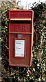
Queen Elizabeth II postbox near Church View, Much Dewchurch
At the edge of a hedge http://www.geograph.org.uk/photo/4863930 alongside the B4348 near the Church View junction.
Image: © Jaggery
Taken: 13 Mar 2016
0.10 miles
5
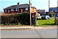
Postbox at the edge of a hedge in the southeast of Much Dewchurch
The Queen Elizabeth II postbox http://www.geograph.org.uk/photo/4863928 is alongside the B4348 near the Church View junction.
Image: © Jaggery
Taken: 13 Mar 2016
0.10 miles
6
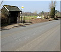
Church View bus stop and shelter, Much Dewchurch
Alongside the B4348 in the southeast of the village. This side for buses to Hereford railway station.
The timetable on display in March 2016 shows that there is only one bus a day in each direction, and only on Mondays, Wednesdays and Fridays. The bus leaves from this stop at 10:51am, arriving outside Hereford railway station at 11:38am. The return bus leaves the railway station at 1:45pm. This journey includes a change of bus at King's Thorn (Little Birch Turn). The bus from King's Thorn is scheduled to arrive at Church View at 2:36pm.
Image: © Jaggery
Taken: 13 Mar 2016
0.10 miles
7
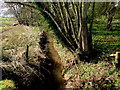
Worm Brook, Much Dewchurch
Viewed from the B4348 in the east of the village.
Image: © Jaggery
Taken: 13 Mar 2016
0.10 miles
8
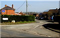
Junction of Church View and the B4348, Much Dewchurch
The name sign on the left shows that Church View leads to Callow View.
Image: © Jaggery
Taken: 13 Mar 2016
0.11 miles
9
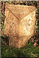
Old Milepost by the B4348, Much Dewchurch parish
Cast iron post by the B4348, in parish of MUCH DEWCHURCH (District), Church View, by hedge, on Northeast side of road. Hereford iron T-post, erected by the Clifford to Dewchurch turnpike trust in the 19th century.
Inscription reads:-
: TO / ROSS / 9 / MILES : : DEWCHURCH / PARISH : : TO / PETERCHUrch / 11 / MILES :
Herefordshire SMR listed.
SMR Number: 56760 https://www.heritagegateway.org.uk/Gateway/Results_Single.aspx?uid=MHE28515&resourceID=101
Milestone Society National ID: HF_RSPC09.
Image: © Robert Walker
Taken: 7 Jan 2012
0.12 miles
10
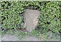
Old Milepost by the B4348, Much Dewchurch parish
Cast iron post by the B4348, in parish of MUCH DEWCHURCH (District), Church View, by hedge, on Northeast side of road. Hereford iron T-post, erected by the Clifford to Dewchurch turnpike trust in the 19th century.
Inscription reads:-
: TO / ROSS / 9 / MILES : : DEWCHURCH / PARISH : : TO / PETERCHUrch / 11 / MILES :
Herefordshire SMR listed.
SMR Number: 56760 https://www.heritagegateway.org.uk/Gateway/Results_Single.aspx?uid=MHE28515&resourceID=101
Milestone Society National ID: HF_RSPC09.
Image: © Roadside Relics
Taken: 30 Apr 2022
0.12 miles