
IMAGES TAKEN NEAR TO
Beattie Avenue, HEREFORD, HR2 7BT
Introduction
This page details the photographs taken nearby to Beattie Avenue, HR2 7BT by members of the Geograph project.
The Geograph project started in 2005 with the aim of publishing, organising and preserving representative images for every square kilometre of Great Britain, Ireland and the Isle of Man.

There are currently over 7.5m images from over14,400 individuals and you can help contribute to the project by visiting https://www.geograph.org.uk
Image Map
Images are licensed for reuse under creativecommons.org/licenses/by-sa/2.0
Notes
- Clicking on the map will re-center to the selected point.
- The higher the marker number, the further away the image location is from the centre of the postcode.
Image Listing (48 Images Found)
Images are licensed for reuse under creativecommons.org/licenses/by-sa/2.0
Image
Details
Distance
1
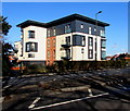
Gilbert Court, Hereford
Recently-built flats on the corner of Belmont Road and Beattie Avenue viewed in February 2017.
Image: © Jaggery
Taken: 7 Feb 2017
0.12 miles
2
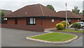
Garden Double Rooms, Three Counties Hotel, Hereford
Resembling small bungalows, the single storey buildings are part of the Three Counties Hotel. http://www.geograph.org.uk/photo/3105871
The building nearest the camera contains two double rooms. Their separate en-suite bathrooms are located in the central part of the building and thus act as a sound muffler between the two rooms.
Image: © Jaggery
Taken: 27 Aug 2012
0.13 miles
3
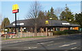
McDonald's Belmont Road Hereford
Viewed across Belmont Road from the corner of Goodrich Grove.
At the end of 2010, Subway was the largest fast food chain in the world based on the total number
of restaurants, but McDonald's was the largest in terms of revenue.
Image: © Jaggery
Taken: 13 Jan 2012
0.13 miles
4
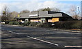
McDonald's, Belmont Road, Hereford
Fast food restaurant on the north side of the A465 Belmont Road.
Behind the hedge, cars are alongside the Drive Thru part of McDonald's.
Image: © Jaggery
Taken: 7 Feb 2017
0.14 miles
5
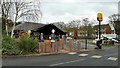
McDonald's restaurant, Belmont, Hereford
Part of the Newton Farm estate can be seen on the other side of the A465.
Image: © Jonathan Billinger
Taken: 20 Nov 2019
0.14 miles
6
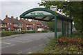
Belmont Road, Hereford
The A465 enjoys a brief Sunday afternoon lull in traffic by the bus shelter at The Oval.
Image: © Stephen McKay
Taken: 31 Jul 2011
0.14 miles
7
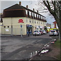
The Oval Community Shops, Hereford
Row of shops set back from the south side of Belmont Road.
Image: © Jaggery
Taken: 7 Feb 2017
0.15 miles
8
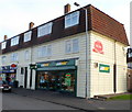
Subway, The Oval, Hereford
The Oval is misnamed. Its shape is a semicircle, located on the south side of Belmont Road (A465).
The Subway fast food restaurant and takeaway is located at the end of a row of shops along the straight line of the semicircle. On the left is a post office inside a McColl's store. http://www.geograph.org.uk/photo/2537940
Image: © Jaggery
Taken: 13 Jan 2012
0.15 miles
9
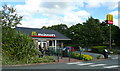
McDonald's, Abergavenny Road, Hereford
Built in the last decade.
Image: © Jonathan Billinger
Taken: 12 Aug 2008
0.15 miles
10

McColl's convenience store and a post office, The Oval, Hereford
A post office is inside this convenience store at 7 The Oval, on the south side of the A465 Belmont Road.
Image: © Jaggery
Taken: 7 Feb 2017
0.15 miles