1
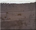
Ordnance Survey Cut Mark
This almost lost OS cut mark can be found on No17 Charles Witts Avenue. It marks a point 55.102m above mean sea level.
Image: © Adrian Dust
Taken: 10 Mar 2019
0.02 miles
2
Ordnance Survey Cut Mark
This OS cut mark can be found on No17 Lewis Smith Avenue. It marks a point 55.312m above mean sea level.
Image: © Adrian Dust
Taken: 10 Mar 2019
0.07 miles
3
Ordnance Survey Cut Mark
This OS cut mark can be found on No62 Charles Witts Avenue. It marks a point 54.824m above mean sea level.
Image: © Adrian Dust
Taken: 10 Mar 2019
0.09 miles
4
No footway for 50 yards, Luard Walk, Hereford
The location is the south bank of the River Wye, viewed from the corner of Wallis Avenue looking ENE.
Image: © Jaggery
Taken: 13 Jan 2012
0.09 miles
5
Villa Street left, Luard Walk right, Hereford
This T-junction is on the south bank of the River Wye, viewed from Wallis Avenue.
Image: © Jaggery
Taken: 13 Jan 2012
0.09 miles
6
South from Hunderton Bridge, Hereford
For more than a century, (1854-1966) this was the route of a railway. Hunderton Bridge, http://www.geograph.org.uk/photo/3519523 a few metres behind the camera, carried the railway across the River Wye. Now the route is a footpath and cycleway, part of National Cycle Network route 46.
Image: © Jaggery
Taken: 27 Aug 2012
0.10 miles
7
Villa Street, Hereford
Viewed from the corner of Wallis Avenue. Villa Street is on the south bank of the River Wye.
Image: © Jaggery
Taken: 13 Jan 2012
0.10 miles
8
The Vaga Tavern, Hunderton, Hereford
A classic backstreet local situated in a quiet street of Hereford's south bank.
Image: © Jonathan Billinger
Taken: 20 Feb 2015
0.11 miles
9
Wye upstream from Hunderton Bridge, Hereford
A view west from this http://www.geograph.org.uk/photo/3519523 bridge along an unusually straight section of the River Wye, which mostly follows a sinuous course hereabouts.
Image: © Jaggery
Taken: 27 Aug 2012
0.11 miles
10
Vaga Street, Hunderton, Hereford
The car park for the Vaga Tavern to the left; houses on Villa Street at the T junction front the River Wye.
Image: © Jonathan Billinger
Taken: 20 Feb 2015
0.12 miles


