
IMAGES TAKEN NEAR TO
Wallis Avenue, HEREFORD, HR2 7AZ
Introduction
This page details the photographs taken nearby to Wallis Avenue, HR2 7AZ by members of the Geograph project.
The Geograph project started in 2005 with the aim of publishing, organising and preserving representative images for every square kilometre of Great Britain, Ireland and the Isle of Man.

There are currently over 7.5m images from over14,400 individuals and you can help contribute to the project by visiting https://www.geograph.org.uk
Image Map
Images are licensed for reuse under creativecommons.org/licenses/by-sa/2.0
Notes
- Clicking on the map will re-center to the selected point.
- The higher the marker number, the further away the image location is from the centre of the postcode.
Image Listing (81 Images Found)
Images are licensed for reuse under creativecommons.org/licenses/by-sa/2.0
Image
Details
Distance
1
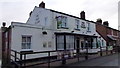
The Vaga Tavern, Hunderton, Hereford
A classic backstreet local situated in a quiet street of Hereford's south bank.
Image: © Jonathan Billinger
Taken: 20 Feb 2015
0.06 miles
2
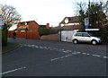
Villa Street left, Luard Walk right, Hereford
This T-junction is on the south bank of the River Wye, viewed from Wallis Avenue.
Image: © Jaggery
Taken: 13 Jan 2012
0.06 miles
3
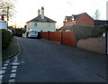
Villa Street, Hereford
Viewed from the corner of Wallis Avenue. Villa Street is on the south bank of the River Wye.
Image: © Jaggery
Taken: 13 Jan 2012
0.06 miles
4
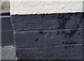
Ordnance Survey Cut Mark
This OS cut mark can be found on No17 Lewis Smith Avenue. It marks a point 55.312m above mean sea level.
Image: © Adrian Dust
Taken: 10 Mar 2019
0.06 miles
5
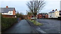
Vaga Street, Hunderton, Hereford
The car park for the Vaga Tavern to the left; houses on Villa Street at the T junction front the River Wye.
Image: © Jonathan Billinger
Taken: 20 Feb 2015
0.07 miles
6
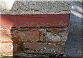
Ordnance Survey Cut Mark
This almost lost OS cut mark can be found on No17 Charles Witts Avenue. It marks a point 55.102m above mean sea level.
Image: © Adrian Dust
Taken: 10 Mar 2019
0.07 miles
7
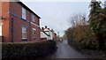
Villa Street, Hunderton, Hereford
Housing from the early 20th century on a road parallel to the River Wye, unseen to the right of shot.
Image: © Jonathan Billinger
Taken: 20 Feb 2015
0.09 miles
8
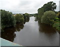
Wye upstream from Hunderton Bridge, Hereford
A view west from this http://www.geograph.org.uk/photo/3519523 bridge along an unusually straight section of the River Wye, which mostly follows a sinuous course hereabouts.
Image: © Jaggery
Taken: 27 Aug 2012
0.10 miles
9
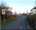
No footway for 50 yards, Luard Walk, Hereford
The location is the south bank of the River Wye, viewed from the corner of Wallis Avenue looking ENE.
Image: © Jaggery
Taken: 13 Jan 2012
0.11 miles
10
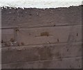
Ordnance Survey Cut Mark
This OS cut mark can be found on No62 Charles Witts Avenue. It marks a point 54.824m above mean sea level.
Image: © Adrian Dust
Taken: 10 Mar 2019
0.12 miles