
IMAGES TAKEN NEAR TO
Blackmarston Road, HEREFORD, HR2 7AJ
Introduction
This page details the photographs taken nearby to Blackmarston Road, HR2 7AJ by members of the Geograph project.
The Geograph project started in 2005 with the aim of publishing, organising and preserving representative images for every square kilometre of Great Britain, Ireland and the Isle of Man.

There are currently over 7.5m images from over14,400 individuals and you can help contribute to the project by visiting https://www.geograph.org.uk
Image Map
Images are licensed for reuse under creativecommons.org/licenses/by-sa/2.0
Notes
- Clicking on the map will re-center to the selected point.
- The higher the marker number, the further away the image location is from the centre of the postcode.
Image Listing (59 Images Found)
Images are licensed for reuse under creativecommons.org/licenses/by-sa/2.0
Image
Details
Distance
1
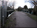
North across a former railway bridge, Hereford
A combined footpath and cycleway, part of National Cycle Network route 46, crosses this http://www.geograph.org.uk/photo/5280303 bridge over Belmont Road. A nearby sign pointing this way shows City centre 7 min(ute)s, Redhill 7 min(ute)s. As it is a cycle route sign, it's likely these times are for an average cyclist. If so, an average walker would need about 20 minutes.
Image: © Jaggery
Taken: 7 Feb 2017
0.08 miles
2
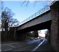
Former railway bridge over the A465 Belmont Road, Hereford
In February 2017 the former railway route across the bridge is a combined footpath and cycleway,
part of National Cycle Network route 46. Headroom shown is 4.9 metres/16' 0".
Image: © Jaggery
Taken: 7 Feb 2017
0.08 miles
3
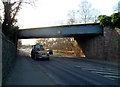
Former railway bridge over Belmont Road, Hereford
The railway lines on the bridge were removed long ago. It is now part of a footpath.
Headroom under the bridge is 16ft (4.9m).
Image: © Jaggery
Taken: 13 Jan 2012
0.08 miles
4
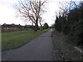
National Cycle Network route 46 towards Hereford city centre
A combined cycleway and footpath on a former railway route, viewed from the northern end of this bridge. http://www.geograph.org.uk/photo/5280328
Image: © Jaggery
Taken: 7 Feb 2017
0.09 miles
5
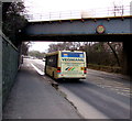
Yeomans bus, Belmont Road, Hereford
The Yeomans Canyon Travel bus is on route 448 from Hereford Country Bus
Station to Shenmore via Clehonger, Madley, Preston-on-Wye and Bredwardine.
Image: © Jaggery
Taken: 7 Feb 2017
0.09 miles
6
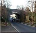
Former Hunderton Road railway bridge, Hereford
Formerly carrying a railway over Hunderton Road, the 10' 9" headroom stone bridge now carries a footpath.
Image: © Jaggery
Taken: 13 Jan 2012
0.09 miles
7
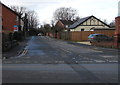
Hunderton Road, Hereford
From Belmont Road along Hunderton Road towards a former railway bridge.
Image: © Jaggery
Taken: 7 Feb 2017
0.09 miles
8
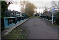
South across a former railway bridge, Hereford
A combined footpath and cycleway, part of National Cycle Network route 46, crosses this http://www.geograph.org.uk/photo/5280303 bridge over Belmont Road.
Image: © Jaggery
Taken: 7 Feb 2017
0.09 miles
9
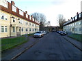
Hunderton Road flats, Hereford
A view SE along Hunderton Road towards a former railway bridge. http://www.geograph.org.uk/photo/3492466
Image: © Jaggery
Taken: 13 Jan 2012
0.09 miles
10
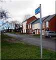
Footpath and cycle route towards Hereford city centre
The small red white and blue sticker on the post shows National Cycle Network route 46.
In February 2017, the Sustrans website states that Route 46 will connect Bromsgrove to Neath when complete.
Image: © Jaggery
Taken: 7 Feb 2017
0.10 miles