IMAGES TAKEN NEAR TO
Broomfield Walk, HEREFORD, HR2 6SE
Introduction
This page details the photographs taken nearby to Broomfield Walk, HR2 6SE by members of the Geograph project.
The Geograph project started in 2005 with the aim of publishing, organising and preserving representative images for every square kilometre of Great Britain, Ireland and the Isle of Man.

There are currently over 7.5m images from over14,400 individuals and you can help contribute to the project by visiting https://www.geograph.org.uk
Image Map
Images are licensed for reuse under creativecommons.org/licenses/by-sa/2.0
Notes
- Clicking on the map will re-center to the selected point.
- The higher the marker number, the further away the image location is from the centre of the postcode.
Image Listing (10 Images Found)
Images are licensed for reuse under creativecommons.org/licenses/by-sa/2.0
Image
Details
Distance
1
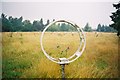
The Aerial Field, Stirling Lines
Now covered by housing
Image: © Paul Taunton
Taken: 2 Aug 2001
0.08 miles
2
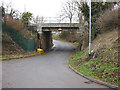
Low bridge
Carrying the railway from Hereford to Abergavenny.
Image: © Pauline E
Taken: 14 Feb 2009
0.16 miles
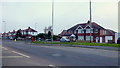
4
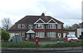
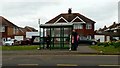
Houses on Ross road (Redhill), Hereford
Showing position of George VI Postbox No. HR2 21.
Image: © JThomas
Taken: 4 Apr 2019
0.23 miles
5
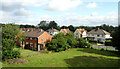
Houses on Ross Road, Hereford
Adjacent to the Bullinghope Lane turn.
Image: © Jonathan Billinger
Taken: 15 Mar 2016
0.23 miles
6
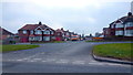
Red Hill Avenue, Hereford
1950's housing viewed from the Ross Road.
Image: © Jonathan Billinger
Taken: 17 Mar 2016
0.24 miles
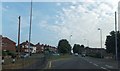
8
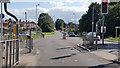
Ross Road and Red Hill, Hereford
The A49, Ross Road entering Hereford from the south.
Image: © Philip Halling
Taken: 26 Apr 2014
0.25 miles
9
Waiting for the Ross bus
Bus shelter on the Ross Road south of Hereford.
Image: © Jonathan Billinger
Taken: 24 Mar 2016
0.25 miles
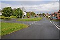
10
Junction of Ross Road and Bullingham Lane
Image: © Helen Steed
Taken: 7 Aug 2019
0.25 miles