
IMAGES TAKEN NEAR TO
Fordshill Road, HEREFORD, HR2 6NS
Introduction
This page details the photographs taken nearby to Fordshill Road, HR2 6NS by members of the Geograph project.
The Geograph project started in 2005 with the aim of publishing, organising and preserving representative images for every square kilometre of Great Britain, Ireland and the Isle of Man.

There are currently over 7.5m images from over14,400 individuals and you can help contribute to the project by visiting https://www.geograph.org.uk
Image Map
Images are licensed for reuse under creativecommons.org/licenses/by-sa/2.0
Notes
- Clicking on the map will re-center to the selected point.
- The higher the marker number, the further away the image location is from the centre of the postcode.
Image Listing (15 Images Found)
Images are licensed for reuse under creativecommons.org/licenses/by-sa/2.0
Image
Details
Distance
1
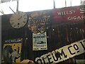
AA Sign, was in Cradoc, 2 miles North West of Brecon
This AA sign was photographed in the Warehouse 701 decorative salvage and homewares’ centre, Fordshill Road, Rotherwas, Hereford, HR2 6NS. It has a circular design, with the village name on a black band, no MU symbol or name, 1923.
The inscription reads: LLANDOVERY 15 / CRADOC / BRECON 2 / LONDON 171
Milestone Society National ID: BRE-CRA
Image: © Milestone Society
Taken: 18 Jul 2019
0.03 miles
2
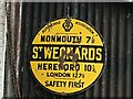
AA Sign, was in St Weonards, 10? miles South of Hereford
The AA sign was photographed in the Warehouse 701 decorative salvage and homewares’ centre, Fordshill Road, Rotherwas, Hereford, HR2 6NS. It has a circular design, with the village name on a black band, no MU symbol or name, 1923.
The inscription reads: MONMOUTH 7½ / St WEONARDS / HEREFORD 10½ / LONDON 127½
Milestone Society National ID: HF-STWEO
Image: © Milestone Society
Taken: 18 Jul 2019
0.03 miles
3
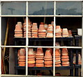
Clay pots anyone?
Architectural salvage at an old factory site run by Wye Valley Reclamation.
http://www.wyevalleygroup.co.uk/news/2/56/Warehouse-701-Wye-Valley-Reclamation-Launches-23rd-May-2013
Image: © Jonathan Billinger
Taken: 8 Aug 2013
0.04 miles
4
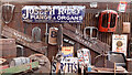
Salvage treasures
One of the many displays in the salvage business, Warehouse 701; https://www.warehouse701.co.uk/
This was formerly Wye Valley Reclamation, see Image
Image: © Jonathan Billinger
Taken: 8 Aug 2020
0.04 miles
5
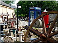
Salvage yard treasures
Architectural salvage at an old factory site run by Wye Valley Reclamation.
http://www.wyevalleygroup.co.uk/news/2/56/Warehouse-701-Wye-Valley-Reclamation-Launches-23rd-May-2013
Image: © Jonathan Billinger
Taken: 8 Aug 2013
0.04 miles
6
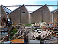
Salvage centre, Rotherwas, Hereford
Architectural salvage at an old factory site run by Wye Valley Reclamation.
http://www.wyevalleygroup.co.uk/news/2/56/Warehouse-701-Wye-Valley-Reclamation-Launches-23rd-May-2013
Image: © Jonathan Billinger
Taken: 8 Aug 2013
0.05 miles
7
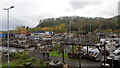
Salvage yard
The outside area at Warehouse 701, with the eastern end of Dinedor Hill in the distance.
Image: © Jonathan Billinger
Taken: 31 Oct 2020
0.07 miles
8
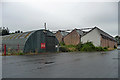
Factories, Rotherwas (3)
The distinctive sawtooth roofs are reminders of the former National Filling (Munitions) Factory, begun by the Office of Works in 1916, and closed in 1967. In front is a Romney hut. Surviving structures are dotted over an area of 500 acres - these are on an industrial estate.
Image: © Stephen Richards
Taken: 13 Aug 2013
0.15 miles
9
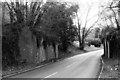
Railway bridge abutments at Rotherwas
The abutments of the former railway bridge over the Hereford - Holme Lacy road. The bridge carried the Hereford - Gloucester line, which was built to Brunel's broad gauge, opened in 1855, converted to standard gauge over five days in 1869 and closed to passenger traffic in 1964.
Image: © John Winder
Taken: Unknown
0.16 miles
10
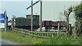
Locomotive on Rotherwas Trading Estate
Locomotive beside the road through Rotherwas Trading Estate.
Image: © Philip Halling
Taken: 18 Apr 2017
0.16 miles