
IMAGES TAKEN NEAR TO
Reynard Close, HEREFORD, HR2 6JH
Introduction
This page details the photographs taken nearby to Reynard Close, HR2 6JH by members of the Geograph project.
The Geograph project started in 2005 with the aim of publishing, organising and preserving representative images for every square kilometre of Great Britain, Ireland and the Isle of Man.

There are currently over 7.5m images from over14,400 individuals and you can help contribute to the project by visiting https://www.geograph.org.uk
Image Map
Images are licensed for reuse under creativecommons.org/licenses/by-sa/2.0
Notes
- Clicking on the map will re-center to the selected point.
- The higher the marker number, the further away the image location is from the centre of the postcode.
Image Listing (32 Images Found)
Images are licensed for reuse under creativecommons.org/licenses/by-sa/2.0
Image
Details
Distance
1
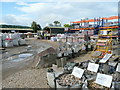
Stone and Aggregate Dealer's Yard
A thriving business on the Rotherwas Industrial Estate.
Image: © Jonathan Billinger
Taken: 25 Aug 2009
0.04 miles
2
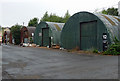
Factories, Rotherwas (4)
These Romney huts are relics of the former National Filling (Munitions) Factory, begun by the Office of Works in 1916, and closed in 1967. Surviving structures are dotted over an area of 500 acres - these are on an industrial estate.
Image: © Stephen Richards
Taken: 13 Aug 2013
0.07 miles
4
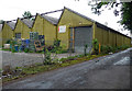
Factories, Rotherwas (1)
The distinctive sawtooth roofs are reminders of the former National Filling (Munitions) Factory, begun by the Office of Works in 1916, and closed in 1967. Surviving structures are dotted over an area of 500 acres - these are on an industrial estate.
Image: © Stephen Richards
Taken: 13 Aug 2013
0.09 miles
6
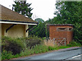
Pillbox, Rotherwas
Dated c1940. A relic of the former National Filling (Munitions) Factory, begun by the Office of Works in 1916, and closed in 1967. Surviving structures are dotted over an area of 500 acres.
Image: © Stephen Richards
Taken: 13 Aug 2013
0.15 miles
7
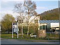
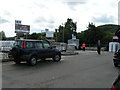
Rotherwas Industrial Estate
The current main industrial zone in Hereford.
Image: © Richard Webb
Taken: 14 Apr 2016
0.15 miles
8
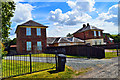
Church Farm, Rotherwas
Next to the chapel and actually the stables of the former mansion, demolished finally in 1926. The estate was acquired by the Government in 1916 and the munitions factory, much of which remains, was established and in its heyday it sprawled over more than 500 acres.
Image: © Philip Pankhurst
Taken: 8 Aug 2016
0.15 miles
9
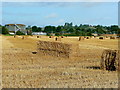
Harvested field at Rotherwas
View west from Church Farm with a part of the Sewage Works in the left distance.
Image: © Jonathan Billinger
Taken: 25 Aug 2009
0.16 miles
10
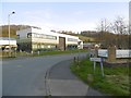
Coldnose Road
Rotherwas is being developed as an industrial area. In a way it is replacing the Holmer Road area in the north of the city which is now distinctly post industrial - retail sheds.
Image: © Richard Webb
Taken: 14 Apr 2016
0.16 miles