
IMAGES TAKEN NEAR TO
Beacon Road, HEREFORD, HR2 6JF
Introduction
This page details the photographs taken nearby to Beacon Road, HR2 6JF by members of the Geograph project.
The Geograph project started in 2005 with the aim of publishing, organising and preserving representative images for every square kilometre of Great Britain, Ireland and the Isle of Man.

There are currently over 7.5m images from over14,400 individuals and you can help contribute to the project by visiting https://www.geograph.org.uk
Image Map
Images are licensed for reuse under creativecommons.org/licenses/by-sa/2.0
Notes
- Clicking on the map will re-center to the selected point.
- The higher the marker number, the further away the image location is from the centre of the postcode.
Image Listing (19 Images Found)
Images are licensed for reuse under creativecommons.org/licenses/by-sa/2.0
Image
Details
Distance
1
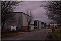
Twyford Road, Hereford
On Rotherwas Industrial Estate, home to my current employers. This was snapped as I left work early one Saturday morning after a night spent asleep in the cab on Beaconsfield services. For which, incidentally, I paid £25 to rent a lorry - sized patch of tarmac for 12 hours, which, hour for hour, is over twice as much as my mortgage!
Image: © John Winder
Taken: 10 Jan 2015
0.06 miles
3
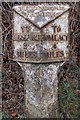
Old Milepost by the B4399, Holme Lacy Road, Lower Bullingham
Cast iron post by the B4399, in parish of LOWER BULLINGHAM (District), West of Industrial estate; 200m from railway bridge, on verge, near Speed Camera sign, on West side of road. Hereford iron T-post, erected by the Hereford turnpike trust in the 19th century.
Inscription reads:-
: TO / HEREFORD / 2 / MILES : : BULLINGHAM / PARISH : : TO / HOMLACY / 4 / MILES :
Herefordshire SMR listed.
SMR Number: 56581 https://www.heritagegateway.org.uk/Gateway/Results_Single.aspx?uid=MHE28338&resourceID=101
Milestone Society National ID: HF_HFHL02.
Image: © T Boyce
Taken: 2 Nov 2003
0.13 miles
4
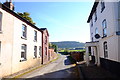
Houses at Dinedor
Houses on Watery Lane, just on the edge of the Rotherwas Industrial Estate near Hereford. Dinedor Hill is visible in the background.
Image: © John Winder
Taken: 21 Oct 2018
0.13 miles
5
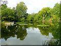
Fishing lake at Rotherwas 2
Another view of this attractive lake in the heart of the industrial area of South Hereford. See also Image
Image: © Jonathan Billinger
Taken: 25 Aug 2009
0.14 miles
6
Lorry leaving Thorn Business Park, Hereford
Image: © Rob Purvis
Taken: 2 Apr 2013
0.15 miles
7
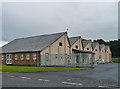
Factories, Rotherwas (2)
The distinctive sawtooth roofs are reminders of the former National Filling (Munitions) Factory, begun by the Office of Works in 1916, and closed in 1967. Surviving structures are dotted over an area of 500 acres - these are on an industrial estate.
Image: © Stephen Richards
Taken: 13 Aug 2013
0.15 miles
8
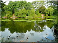
Fishing lake at Rotherwas
Privately owned, but easily accessed from the Thorn Industrial Park.
In this view west, the ducks in the foreground have just splashed down!
Image: © Jonathan Billinger
Taken: 25 Aug 2009
0.16 miles
9
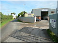
Watery Lane, Lower Bullingham
The lane divides the industry of the Rotherwas estate, right, from the open farmland north of Dinedor Hill, over the hedge left.
Image: © Jonathan Billinger
Taken: 25 Aug 2009
0.16 miles
10
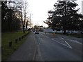
The Straight Mile
The Hereford to Holme Lacy road passing through the Rotherwas Industrial Estate.
Image: © Richard Webb
Taken: 14 Apr 2016
0.18 miles