
IMAGES TAKEN NEAR TO
Hawthorn Grove, HEREFORD, HR2 6AU
Introduction
This page details the photographs taken nearby to Hawthorn Grove, HR2 6AU by members of the Geograph project.
The Geograph project started in 2005 with the aim of publishing, organising and preserving representative images for every square kilometre of Great Britain, Ireland and the Isle of Man.

There are currently over 7.5m images from over14,400 individuals and you can help contribute to the project by visiting https://www.geograph.org.uk
Image Map
Images are licensed for reuse under creativecommons.org/licenses/by-sa/2.0
Notes
- Clicking on the map will re-center to the selected point.
- The higher the marker number, the further away the image location is from the centre of the postcode.
Image Listing (45 Images Found)
Images are licensed for reuse under creativecommons.org/licenses/by-sa/2.0
Image
Details
Distance
1

Hawthorn Grove, Putson
Older suburb to the south of Hereford.
Image: © Jonathan Billinger
Taken: 25 Aug 2009
0.02 miles
2
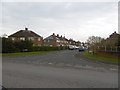
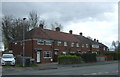
Willow Grove, Putson
Part of the 20th century expansion of Hereford south of the Wye.
Image: © Richard Webb
Taken: 14 Apr 2016
0.07 miles
4
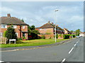
Beech Grove, Putson
Older suburb to the south of Hereford.
Image: © Jonathan Billinger
Taken: 25 Aug 2009
0.07 miles
5
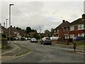
Hinton Close
Postwar housing south of the river.
Image: © Richard Webb
Taken: 9 Jul 2024
0.07 miles
6
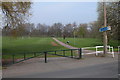
Cycleway and Footpath, Blackmarstone
Cycleway and footpath to Hereford city centre.
Image: © Philip Halling
Taken: 22 Apr 2006
0.09 miles
7
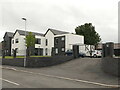
King George's View
Named after the nearby playing fields. Recently built on the site of 20th century houses.
Image: © Richard Webb
Taken: 9 Jul 2024
0.09 miles
8
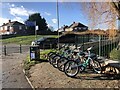
Beryl Bikes, Hereford
Bike-share scheme in Hereford where there are 200 Beryl Bikes and 30 Beryl e-Bikes available from 65 Beryl Bays (the bay is marked green on the pavement)
Image: © Eirian Evans
Taken: 20 Jan 2022
0.11 miles
9
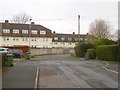
Maple Grove
Looking towards flats on Oak Crescent. This is an interwar housing development off Holme Lacy Road, and an early part of the southward expansion of Hereford.
Image: © Richard Webb
Taken: 14 Apr 2016
0.12 miles
10
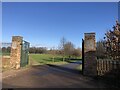
Gates at King George's Field
A King George's Field is a public open space in the United Kingdom dedicated to the memory of King George V. After the King's death in 1936, the Lord Mayor of London formed a committee to determine a memorial that was not solely based on the idea of a statue. They arrived the same year at the concept of funding and erecting a single statue in London and setting up the King George's Fields Foundation with the aim of promoting the establishment of playing fields for the use and enjoyment of the people of the UK and Northern Ireland. Each would be called 'King George's Field' and to have heraldic panels on the entrance gates.
Image: © Eirian Evans
Taken: 20 Jan 2022
0.12 miles