
IMAGES TAKEN NEAR TO
Peterchurch, HEREFORD, HR2 0SG
Introduction
This page details the photographs taken nearby to HR2 0SG by members of the Geograph project.
The Geograph project started in 2005 with the aim of publishing, organising and preserving representative images for every square kilometre of Great Britain, Ireland and the Isle of Man.

There are currently over 7.5m images from over14,400 individuals and you can help contribute to the project by visiting https://www.geograph.org.uk
Image Map
Images are licensed for reuse under creativecommons.org/licenses/by-sa/2.0
Notes
- Clicking on the map will re-center to the selected point.
- The higher the marker number, the further away the image location is from the centre of the postcode.
Image Listing (40 Images Found)
Images are licensed for reuse under creativecommons.org/licenses/by-sa/2.0
Image
Details
Distance
1
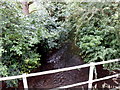
River Dore, Peterchurch
Viewed from the lane from the B4348 to Fairfield High School. http://www.geograph.org.uk/photo/3070175
The Dore is a tributary of the River Monnow.
Image: © Jaggery
Taken: 5 Aug 2012
0.04 miles
2
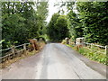
Bridge over the Dore, Peterchurch
The lane from the B4348 to Fairfield High School http://www.geograph.org.uk/photo/3070175 crosses over the River Dore. http://www.geograph.org.uk/photo/3070288
Image: © Jaggery
Taken: 5 Aug 2012
0.04 miles
3

Stile leading to a footpath on the bank of the River Dore, Peterchurch
The stile is located a few metres from this bridge http://www.geograph.org.uk/photo/3070293
Image: © Jaggery
Taken: 5 Aug 2012
0.04 miles
4
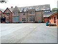
Fairfield High School, Peterchurch
The school is in a rural location to the west of the main residential part of the village.
Image: © Jaggery
Taken: 5 Aug 2012
0.04 miles
5
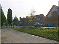
Fairfield School
Fairfield School, Peterchurch
Image: © Alan Spencer
Taken: 26 Oct 2009
0.05 miles
6
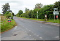
Bus stop and village notice board, Peterchurch
Viewed across the B4348, the main road through the village. One bus stop sign indicates bus stops on both sides of the road. The village is on bus route 39, Brecon to Hereford and Hereford to Brecon.
Image: © Jaggery
Taken: 5 Aug 2012
0.11 miles
7
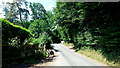
Road to Urishay
Minor road heading west from Peterchurch, over the Dore bridge, up into the rolling Golden Valley countryside.
Image: © Jonathan Billinger
Taken: 18 Jul 2015
0.11 miles
8
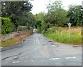
Lane to Fairfield High School, Peterchurch
Viewed across the B4348, the main road through the village.
The lane heads towards the school http://www.geograph.org.uk/photo/3070175 located in a rural setting about 300 metres ahead.
Image: © Jaggery
Taken: 5 Aug 2012
0.15 miles
9
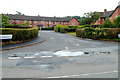
Closure Place, Peterchurch
Houses viewed from the B4348, main road through the village
Image: © Jaggery
Taken: 5 Aug 2012
0.16 miles
10
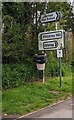
Directions on the approach to crossroads, Peterchurch, Herefordshire
Signs alongside the B4348 show left for Stockley Hill,
right for Fairfield High School and Urishay.
Image: © Jaggery
Taken: 23 Apr 2023
0.17 miles