
IMAGES TAKEN NEAR TO
Peterchurch, HEREFORD, HR2 0RU
Introduction
This page details the photographs taken nearby to HR2 0RU by members of the Geograph project.
The Geograph project started in 2005 with the aim of publishing, organising and preserving representative images for every square kilometre of Great Britain, Ireland and the Isle of Man.

There are currently over 7.5m images from over14,400 individuals and you can help contribute to the project by visiting https://www.geograph.org.uk
Image Map
Images are licensed for reuse under creativecommons.org/licenses/by-sa/2.0
Notes
- Clicking on the map will re-center to the selected point.
- The higher the marker number, the further away the image location is from the centre of the postcode.
Image Listing (51 Images Found)
Images are licensed for reuse under creativecommons.org/licenses/by-sa/2.0
Image
Details
Distance
1
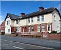
Edwardian houses, Peterchurch
Viewed across the B4348. The year 1904 is inscribed on the wall.
Image: © Jaggery
Taken: 5 Aug 2012
0.01 miles
2
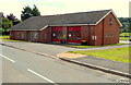
Peterchurch Fire Station
Part of the West District of Hereford & Worcester Fire and Rescue Service,
the fire station is alongside the B4348 in the north of the village.
Image: © Jaggery
Taken: 5 Aug 2012
0.03 miles
3
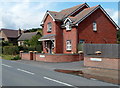
Thornberry Close houses, Peterchurch
Located alongside the B4348 in the north of the village.
Image: © Jaggery
Taken: 5 Aug 2012
0.04 miles
4
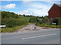
Chapel Lane, Peterchurch
Chapel Lane heads east away from the B4348 in the north of the village.
Image: © Jaggery
Taken: 5 Aug 2012
0.04 miles
5
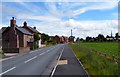
Main road through Peterchurch
Looking SSE along the B4348 through the Herefordshire village of Peterchurch.
Image: © Jaggery
Taken: 5 Aug 2012
0.04 miles
6
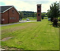
Peterchurch fire station tower
The training and drill tower is located on the NW side of the fire station. http://www.geograph.org.uk/photo/3702198
Image: © Jaggery
Taken: 5 Aug 2012
0.04 miles
7
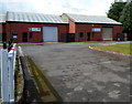
Two units in Old Forge Industrial Estate, Peterchurch
Unit 9 on the left was to let at the August 2012 date of this view.
The name on unit 8 on the right is John Slough of London & Arms Fairs Limited.
Image: © Jaggery
Taken: 5 Aug 2012
0.06 miles
8
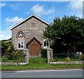
Wesley Place, Peterchurch
Former chapel or church converted to residential use.
Image: © Jaggery
Taken: 5 Aug 2012
0.07 miles
9
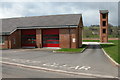
Fire Station, Peterchurch
Retained Fire Station opened in 2001
Image: © Philip Halling
Taken: 17 Apr 2006
0.07 miles
10
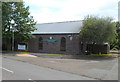
Bordercraft in Peterchurch
Located in the Old Forge Industrial Estate alongside the B4348,
Bordercraft manufactures wide planked hardwood worktops and furniture.
Image: © Jaggery
Taken: 5 Aug 2012
0.08 miles