IMAGES TAKEN NEAR TO
Longtown, HEREFORD, HR2 0LZ
Introduction
This page details the photographs taken nearby to HR2 0LZ by members of the Geograph project.
The Geograph project started in 2005 with the aim of publishing, organising and preserving representative images for every square kilometre of Great Britain, Ireland and the Isle of Man.

There are currently over 7.5m images from over14,400 individuals and you can help contribute to the project by visiting https://www.geograph.org.uk
Image Map
Images are licensed for reuse under creativecommons.org/licenses/by-sa/2.0
Notes
- Clicking on the map will re-center to the selected point.
- The higher the marker number, the further away the image location is from the centre of the postcode.
Image Listing (11 Images Found)
Images are licensed for reuse under creativecommons.org/licenses/by-sa/2.0
Image
Details
Distance
1
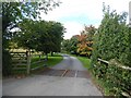
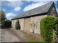
Driveway to Shepherd's Hill
Flanked by ornamental trees.
Image: © Oliver Dixon
Taken: 3 Sep 2020
0.08 miles
2
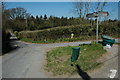
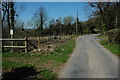
Junction known as 'Old Court Turn'
Road junction between Longtown and Ewyas Harold. This road junction is known as 'Old Court Turn' and originally as 'Sarah's Turn' - an old lady lived just to the left of the picture, her name was Sarah.
Image: © Philip Halling
Taken: 17 Apr 2010
0.11 miles
3
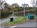
Road junction between Longtown and Ewyas Harold
This road junction is known as 'Old Court Turn' and originally as 'Sarah's Turn' - an old lady lived just to the left of the picture, her name was Sarah.
Image: © Philip Halling
Taken: 11 Nov 2006
0.13 miles
4
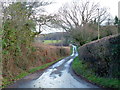
Lane to Maes-coed
Maes-y-fedw Wood in the distance.
Image: © Jonathan Billinger
Taken: 21 Jan 2012
0.14 miles
5
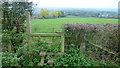
Old School Mid MC
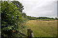
Field where footpath meets the road
Image: © P Gaskell
Taken: Unknown
0.16 miles
6
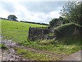
Felled woodland
Recently felled woodland opposite Maes-y-fedw Wood.
Image: © Philip Halling
Taken: 17 Apr 2010
0.20 miles
8
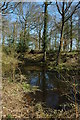
Maes-y-fedw Wood
Pond in Maes-y-fedw Wood.
Image: © Philip Halling
Taken: 17 Apr 2010
0.21 miles
10
Footpath north of Mynydd Merddin
Also named Mynydd Ferddin on OS mapping.
Image: © Jonathan Billinger
Taken: 17 Oct 2015
0.22 miles