
IMAGES TAKEN NEAR TO
Ewyas Harold, HEREFORD, HR2 0JD
Introduction
This page details the photographs taken nearby to HR2 0JD by members of the Geograph project.
The Geograph project started in 2005 with the aim of publishing, organising and preserving representative images for every square kilometre of Great Britain, Ireland and the Isle of Man.

There are currently over 7.5m images from over14,400 individuals and you can help contribute to the project by visiting https://www.geograph.org.uk
Image Map
Images are licensed for reuse under creativecommons.org/licenses/by-sa/2.0
Notes
- Clicking on the map will re-center to the selected point.
- The higher the marker number, the further away the image location is from the centre of the postcode.
Image Listing (48 Images Found)
Images are licensed for reuse under creativecommons.org/licenses/by-sa/2.0
Image
Details
Distance
1

Ewyas Harold Common
Pond near the southeast corner of Ewyas Harold Common.
Image: © Ian Capper
Taken: 18 May 2021
0.02 miles
2

Ewyas Harold Common
An area near the southeast corner of Ewyas Harold Common. In the far distance are the Black Mountains.
Image: © Ian Capper
Taken: 18 May 2021
0.02 miles
3

Former pond on the common
A pond was created here a few years ago but has not been maintained.
Image: © Hugh Venables
Taken: 13 Aug 2008
0.03 miles
4

Dark Lane away from Ewyas Harold
Looking NE along Dark Lane from near the corner of Fern Bank.
Image: © Jaggery
Taken: 3 Dec 2017
0.07 miles
5

Cattle grid and information board at the southern entrance to Ewyas Harold Common
The northern end of Dark Lane is at this cattle grid, beyond which is an information board which gives details about the common.
Ewyas Harold Common covers an area of 50 hectares on a plateau above Herefordshire's Golden Valley. Its highest point is 164 metres (c538 feet) above mean sea level. Parts of the common are bounded by ancient sunken lanes. Elsewhere, the edge coincides with medieval parish boundaries.
Image: © Jaggery
Taken: 9 Sep 2011
0.07 miles
6

Police notice at the southern entrance to Ewyas Harold Common
The notice is a few metres from this http://www.geograph.org.uk/photo/3223047 cattle grid. The notice specifies what you should and (mostly) shouldn't do on the common. It uses the apparently oxymoronic phrase "private common"...
Image: © Jaggery
Taken: 9 Sep 2011
0.07 miles
7
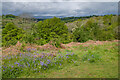
Ewyas Harold Common
An area near the southeast corner of Ewyas Harold Common. In the far distance are the Black Mountains culminating in Hay Bluff in the centre of the photo.
Image: © Ian Capper
Taken: 18 May 2021
0.08 miles
8
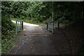
Cattle grid onto common
There is now grazing again on the common, hence cattle grids on each of the entrances.
Image: © Hugh Venables
Taken: 13 Aug 2008
0.08 miles
9

Daffodils above Ewyas Harold
Daffodils on the southern edge of Ewyas Harold Common.
Image: © Philip Halling
Taken: 17 Apr 2010
0.08 miles
10

Pond near Ewyas Harold Common
Bit low on water in Jan 2017.
Image: © Jeremy Bolwell
Taken: 8 Jan 2017
0.10 miles