IMAGES TAKEN NEAR TO
Pontrilas, HEREFORD, HR2 0EH
Introduction
This page details the photographs taken nearby to HR2 0EH by members of the Geograph project.
The Geograph project started in 2005 with the aim of publishing, organising and preserving representative images for every square kilometre of Great Britain, Ireland and the Isle of Man.

There are currently over 7.5m images from over14,400 individuals and you can help contribute to the project by visiting https://www.geograph.org.uk
Image Map
Images are licensed for reuse under creativecommons.org/licenses/by-sa/2.0
Notes
- Clicking on the map will re-center to the selected point.
- The higher the marker number, the further away the image location is from the centre of the postcode.
Image Listing (68 Images Found)
Images are licensed for reuse under creativecommons.org/licenses/by-sa/2.0
Image
Details
Distance
1
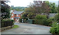
Pontrilas bus shelter
Viewed from the access road to the former Pontrilas railway station. http://www.geograph.org.uk/photo/2589093
The bus stop is used mainly by Stagecoach service X4 http://www.geograph.org.uk/photo/2773844 from Abergavenny to Hereford.
Image: © Jaggery
Taken: 9 Sep 2011
0.01 miles
2
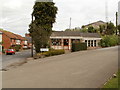
The Border Property Centre, Pontrilas
Premises of Nigel Ward & Co, estate agents and auctioneers.
Image: © Jaggery
Taken: 6 Sep 2011
0.01 miles
3
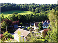
Pontrilas
Looking over Pontrilas to Callow Hill Wood beyond.
Image: © Stuart Wilding
Taken: 19 Jul 2008
0.02 miles
4
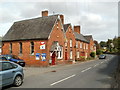
Doyre Terrace, Pontrilas
A short row of houses on the north side of the road through the small village of Pontrilas.
Image: © Jaggery
Taken: 6 Sep 2011
0.05 miles
5
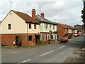
Pontrilas houses
Houses on the unnamed central road through the village, viewed from the edge of Ward & Co's premises. http://www.geograph.org.uk/photo/2590317
Image: © Jaggery
Taken: 6 Sep 2011
0.05 miles
6
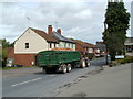
Pontrilas shuttle
This tractor and trailer passed me several times during my visit to the area. Each time, the trailer was fully loaded when travelling in this direction, and empty in the opposite direction. The trailer is full of potatoes.
Viewed from the edge of Ward & Co's premises. http://www.geograph.org.uk/photo/2590317
Image: © Jaggery
Taken: 6 Sep 2011
0.05 miles
7
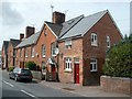
The Old Post Office, Pontrilas
There is a small sign showing 'The Old Post Office' on the wall of the corner house, at the end of a short row of houses, Doyre Terrace. The current post office http://www.geograph.org.uk/photo/2588933 is about 70 metres behind the camera.
Image: © Jaggery
Taken: 6 Sep 2011
0.05 miles
8
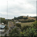
Very tall communications mast, Pontrilas
Located at the edge of railway lines on the site of the former railway station, the mast is by far the tallest structure in the area.
Image: © Jaggery
Taken: 9 Sep 2011
0.05 miles
9
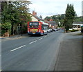
Stagecoach bus in Pontrilas
A Stagecoach bus, on route X4 from Abergavenny to Hereford, passes through Pontrilas.
Image: © Jaggery
Taken: 9 Sep 2011
0.05 miles