
IMAGES TAKEN NEAR TO
Pontrilas, HEREFORD, HR2 0DL
Introduction
This page details the photographs taken nearby to HR2 0DL by members of the Geograph project.
The Geograph project started in 2005 with the aim of publishing, organising and preserving representative images for every square kilometre of Great Britain, Ireland and the Isle of Man.

There are currently over 7.5m images from over14,400 individuals and you can help contribute to the project by visiting https://www.geograph.org.uk
Image Map
Images are licensed for reuse under creativecommons.org/licenses/by-sa/2.0
Notes
- Clicking on the map will re-center to the selected point.
- The higher the marker number, the further away the image location is from the centre of the postcode.
Image Listing (5 Images Found)
Images are licensed for reuse under creativecommons.org/licenses/by-sa/2.0
Image
Details
Distance
1
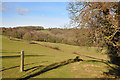
Herefordshire Farmland
In the distance can be seen Dineterwood.
Image: © Stuart Wilding
Taken: 2 Mar 2009
0.06 miles
2
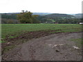
Looking down into Pontrilas
The wood on the left is Cae-newydd Wood and the wooded hill in the middle distance is Callow Hill Wood.
Image: © Philip Halling
Taken: 11 Nov 2006
0.09 miles
3
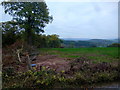
New infrastructure
Well, it looks like a new water supply adjacent to a lane in West Herefordshire.
A few scrubby trees have made way and someone's left their shovel here too.
Image: © Jonathan Billinger
Taken: 17 Oct 2015
0.13 miles
4
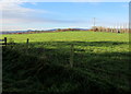
Grazing land in Rowlestone
Rural south Herefordshire in mid November 2017.
Image: © Jaggery
Taken: 19 Nov 2017
0.20 miles
5
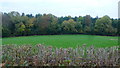
Edge of Paradise Wood
Evocatively-named mixed woodland to the west of Pontrilas.
Image: © Jonathan Billinger
Taken: 17 Oct 2015
0.21 miles